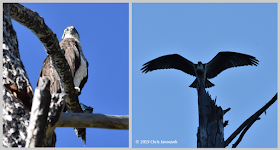
4 Sept 2018. During
my week-long trip to Wyoming last summer, I actually
spent more time in Grand Teton National Park than Yellowstone .
Prior to visiting, I had heard many positive things about Grant Teton, Yellowstone ’s companion to the south. It is smaller, and
less crowded than the more iconic park, but certainly had its share of visitors
over Labor Day weekend.
 |
| Glaciers on the Teton Range. |
The Park encompasses a small granitic mountain range with high
vertical relief, and is part of the greater Yellowstone
ecosystem. The short range runs from south to north and is adjacent to a wide
flat valley situated to the east. The dramatic vertical difference between the
valley (which lies at about 7000 ft) and the higher of the Teton peaks (which
rise to about 14,000 ft) owes it origin to north-south fault activity. Repeated
occurrences of large earthquakes led to the uplift of a large block of granite
that became the Teton Range .
Deep valleys among the mountains offer some beautiful
scenery and opportunity for exploration. Glacial activity has played at least
some role in carving out this topography, and there are some small glaciers
that are still visible on the eastern side of the range. Glaciers have also
presumably contributed to the presence of many of the lakes at the base of the higher
mountains. A range of small to large lakes occur at a modest elevation above the
valley floor, their water corralled by sills of rock that I assume were pushed
out by glacial activity when glaciers were much larger than they are today.
Just south of Grand Teton, there is a deep east-west running
valley named Cascade
Canyon String Lake
To ascend up into the canyon there is some elevation gain
from String Lake
 |
| The head of Cascade Canyon near Solitude Lake. |
 |
| Solitude Lake, Grand Teton National Park. |
We returned back through Cascade
Canyon because time didn’t really
permit the additional climb up into Paintbrush
Canyon
 |

No comments:
Post a Comment