Showing posts with label wildflowers. Show all posts

23 July 2017

Avalanche Lake

While at Glacier NP, we camped at Avalanche, where a popular but scenic trail leads from the campsite deeper into one of the mountain valleys in the park. I had hoped to gain a view of the Sperry Glacier from the vicinity of the lake, but the steep topography didn’t allow such a view from the lake basin.

Two views of Avalanche Lake: looking east towards several waterfalls (at
left) and looking west (at right).
Leaving the Avalanche campsite, the trail ascended at a mild slope along Avalanche Creek through a dense conifer forest and after a few kilometers it intersected the oblong lake at the west shore. Here the water was shallow and clear, exposing a dense underwater graveyard of logs covered with the brown ooze of the lake bed. The lake is set in a basin with steep rocky slopes to the north, east, and south. Towards the west end of the lake, the rocky slopes had remnant snow fields feeding several waterfalls and water cascades.


A graveyard of logs in the shallow western
side of Avalanche Lake.


The trail continued along the south shore of the lake with views revealing a splendid turquoise color. The formal trail ended at the southwest corner but by using makeshift log bridges and doing some shallow waling through the icy streams feeding the lake, I continued a bit beyond the trail to the eastern shore.

There were wildflowers at the lake shore - Penstemon, Clematis, asters, and Campanula – and some tiny wetlands at the edge of the forest. The beds of the icy streams were comprised of large cobbles. New snow melt tumbled from the streams sending plumes of turbulence into the otherwise tranquil waters.


References

Phillips HW. 2012. Northern Rocky Mountain Wildflowers. 2nd ed. Falcon Guides, Guilford CT.

Several flowering species at the east end of Avalanche Lake. From left: Prunella vulgaris (Lamiaceae), possibly Mimulus sp., Campanula rotundifolia (Campanulaceae). 
Two blooming asters (Asteraceae) at Avalanche Lake. Left: unknown. Right: Anaphalis
margaritacea
(pearly everlasting).
Rapids along Avalanche Creek.
Interesting rock in cobble bed at shore of Avalanche Lake.

22 July 2017

Glacier wildflowers

Flowers were abundant throughout Glacier, from the lower elevations at Apgar and St. Mary’s to above 6500 ft at Logan Pass.

Bear grass (a misleading common name since the species is in the lily family) was probably the most spectacular species, with dense concentrations of flowering plants covering high elevation hillslopes, especially near the Weeping Wall. This is a relatively new species to me. I first encountered it at Mt. Rainier last year. The inflorescence is an elegant spire of white flowers sitting atop a hemispherical bunch of grass-like leaves. The flowers are lightly aromatic.

Bear grass, Xerophyllum tenax. Left: aspiring inflorescences. Right: close up of flowers.

Dotted saxifrage, Saxifraga bronchialis.
Along the Highline Trail that led north from Logan Pass, there were flowers of all colors. Species along the trail included Saxifraga bronchialis, Trollis albiflorus, Myosotis sylvatica, Ribes lacustre, Zigadenus elegans and Calochortus apiculatus. In common with western Washington and Oregon, there was also blooming twinberry (Lonicera involucrata), and thimbleberry (Rubus parviflorus), the latter species with its large palmate leaves and showy white flowers.

Aquilegia flavescens, a yellow-flowered columbine, was an exciting find at Glacier. I’ve long been familiar with the red-flowered sister species, A. formosa, which can be found frequently in a variety of habitats in the Pacific states. A. flavescens has a very similar flower shape to its sister species, nodding flowers and with spurs that protrude at the back of the flower. It is also found in some locations in British Columbia, Washington and Canada.  


Columbines. Left: Aquilegia flavescens at Glacier NP, July 2017. Upper right: A. formosa at
Mary's Peak in central OR, July 2010. Lower right: A. formosa from Big Sur, CA, July 2015.


References

Phillips HW. 2012. Northern Rocky Mountain Wildflowers 2nd ed. Falcon Guides, Guilford, CT.

Turner M, Gustafson P. 2006. Wildflowers of the Pacific Northwest. Timber Press, Inc., Portland, OR.

Other wildflower species at Glacier NP. From left: Rubus parviflorus, Calochortus apiculatus, and possibly Anemone sp.
Zigadenus elegans, commonly known as "showy death camas", a common
name apparently obtained because the plant is poisonous.
Possibly Myosotis sylvatica.

06 May 2017

Black Rock Canyon at Joshua Tree

A Joshua Tree in the lower Black Rock Canyon.
Joshua Tree National Park was the final NPS stop on my April loop through the Southwest. The park straddles the border of the Mojave and Sonoran deserts, the former encompassing the northern part of the park and extending up to Death Valley, and the latter desert encompassing the southern portion of the park.

Arriving after dark after driving through Kingman, AZ, Mojave National Preserve, and a short segment of old Route 66, I camped in the north central part of the park at the Indian Cove Campground. It was not crowded and a lovely spot, encircled about by the large fractured boulders that are one of the common landscape features of Joshua Tree. The morning light revealed all of the flowers present near my campsite, especially yellow patches of Desert Senna. The area looked like a tended garden with rocks and the lovely flora.

Packing up camp, I drove to the northwest corner of the park for a hike up Black Rock Canyon. There is another campground at the trailhead with a series of trails that radiate to the east and south. The canyon is initially wide, sandy, and full of the other iconic feature of the park: Joshua Trees (Yucca brevifolia). I saw (and heard) several quail in this area including a pair or two. The birds quickly scurried to and fro over the ground, not at all interested in getting close to a human.

Quail at Black Rock Canyon.

With some elevation gain heading along the trail to the south, the valleys grew narrower and rockier, and new woody species and more flowers became evident. I first noticed juniper, then pines (Pinus monophylla) and oaks. Joshua Trees were still present, as was the related but shorter species, Mojave yucca (Y. shidigera).

There were many flowers in bloom, including orange desert mallow (Sphaeralcea ambigua), the common desert dandelion (Malacothrix glabrata), bladderpod (Peritoma arborea), and Wallace’s woolly daisy (Eriophyllum wallacei), a tiny yellow aster found in sand along the edges of the trails. I also observed vines and fruits of wild cucumber, a plant not uncommon in the chaparral of coastal California, with its spiked fruits shaped like kiwis. The fruits in this area were particularly large and seemed to be among the largest I’ve ever seen of this species.

Diversity of blooming plants. Clockwise from upper left: Sphaeralcea ambigua (desert mallow), Phacelia sp., Malacothrix glabrata (desert dandelion), Salvia columbariae (chia), Layia glandulosa (white tidy-tips), and Eschscholzia glyptosperma (desert gold poppy). 

Many cacti were in bloom with their very showy flowers. The beavertail (Opuntia basilaris) had large flowers with concentric layers of ruffled pink petals. There were similarly-colored flowers on the hedgehog cactus (Echinocereus engelmannii) and red blooms on the related E. mojavensis. The flowers of the beavertail had a sweet, perhaps fruity, smell that seemed familiar but I could make the association in my mind.

Blooming cacti. Left: Opuntia basilaris (beavertail cactus). Center: Echinocereus engelmannii. Right: E. mojavensis.

The Black Rock Canyon area had an interesting assortment of wildlife too: the quail previously mentioned, many flying insects, chipmunk, and lizard. I had to pass a swarm of bees on the trail that was congregating around the tiniest of water holes seeping from a rock.

More desert fauna. The bees at right were congregating around a very tiny water
seep from a desert rock.

I am still learning about the differences among the various deserts of the Southwest. The Mojave is the smallest and driest of these deserts (MacKay 2013). Various maps show somewhat different boundaries between the southwest deserts, but basically the Mojave Desert stretches from Joshua Tree NP in the south to the Landcaster area in the west, Death Valley National Park in the north, and the southern tip of Nevada and northwest corner of Arizona to the east (Pavlik 2008, Mackay 2013). To the north of the Mojave is the cooler desert of the Great Basin that encompasses most of Nevada, while to the south and east is the Sonoran Desert that stretches south into the Baja and Sonoran regions of northern Mexico.

Two perspectives on the geographic extent of the Mojave Desert and nearby deserts in the US Southwest. My travels through the Southwest took me through the Great Basin, Colorado Plateau, Arizona/New Mexico Plateau, and Mojave Desert. Base maps from the USGS and EPA; in the public domain.

Sunrise at the Indian Cove Campground.
Some characteristic species can help guide one through the various deserts of the region. The Joshua Trees are indicative of the Mojave, occurring in places from NW Arizona to Joshua Tree to the high desert north of Los Angeles. The Sonoran desert has the iconic saguaro cactus (not seen on my trip) and the wonderful ocotillo with its flaming branch tips of red flowers. I did not see ocotillo in the northern part of Joshua Tree (which is Mojave territory), but saw it in abundance at the southern end of the park on a previous trip (that area is Sonoran territory). Interestingly, I also saw a population along Interstate 40 south of Kingman, AZ.

The Mojave Desert has a high diversity of plant species (>2600), a wide range of elevations which provides for a diversity of habitats, and a rate of plant endemism of about 25% (MacKay 2013). Mackay (2013) suggests the area may be under-explored botanically, with the possibility of future plant discoveries.

References

MacKay P. 2013. Mojave Desert Wildflowers. 2nd ed. Rowman & Littlefield

Pavlik BM. 2008. The California Deserts. An Ecological Rediscovery. University of California Press, Berkeley, CA.

02 May 2017

Arizona's canyons and cinder cones

After backpacking for a night in the Petrified Forest, the rest of my time in northern Arizona was a bit of a whirlwind of short visits to a couple of other NPS and BLM sites including Sunset Crater Volcano National Monument, the south rim of the Grand Canyon, Walnut Canyon National Monument, and BLM land near Kingman for wildflowers.

Sunset Crater Volcano is a small monument located just a short distance north of Flagstaff. It features a black and brick red cinder cone that erupted less than a thousand years ago, and an older and shorter volcano. The smooth slopes of the mountain are lightly forested.

View of Sunset Crater Volcano from the west.

The Grand Canyon is of course world famous, though this was my first time ever visiting the park. I didn’t leave much time in my schedule at all that day, so my visit consisted of a few stops at lookout points along the south rim. The canyon is immense, although I’m not sure I was as impressed with the view as I was with the view from Canyonlands NP the week prior in Utah.

Fisheye view of the Grand Canyon from Moran Point on the south rim.
Walnut Canyon.

Walnut Canyon National Monument is another small NPS unit in the Flagstaff area. A canyon several hundred feet deep winds through the area with grey and beige colored striated rock forming the walls of the canyon. Like Mesa Verde and Bandelier, the canyon contains Ancestral Pueblo cliff dwellings which form one of the main attractions of the site. The canyon floor, slopes, and tops of the mesas are forested with juniper, pinyon pine, and Douglas fir. Banana yucca and Opuntia cacti were common.

En route to southern California, my last Arizona adventures were in the Kingman area in the northwest part of the state. Some distance east of Kingman along Interstate 40 I began to notice abundant wildflowers as I was driving, including the orange flowers of desert mallow. So, in Kingman I stopped at the BLM office to scope out some potential places to wander around and I ended up exploring a little along the western slope of the Hualapai Range. I found a diversity of plants in bloom and collected a few small specimens to press in a book. Farther along I40, south of Kingman, I also discovered blooming ocotillo, one of my favorite desert plants. Growing in tall scraggly tufts from the ground, this species cannot be missed even from a fast-moving car, and even less so when it shows off its fiery red flowers.

Left: Forested volcanic field on a slope just west of Sunset Crater Volcano. Right: Bright yellow lichens colonizing volcanic rock.
Whiptail lizard at Walnut Creek National Monument.
Cliff Dwellings at Walnut Canyon. Unfortunately early explorers and collectors damaged many of the dwellings in this area, including using dynamite to knock down the ancient walls.
Colorado River at Grand Canyon National Park from
Desert View on the south rim.

20 March 2016

Death Valley blooms

Geraea canescens (Desert Gold), the most common
wildflower species at low elevations in Death Valley
National Park. Photo taken at Devil's Cornfield.
Deserts present formidable challenges for plants and animals to craft an existence. Access to water is chief among these challenges. Not only must desert organisms be tolerant of lack of water for many months of the year, they must also be capable of capitalizing on the rare and unpredictable opportunities to acquire water when the rains do come.

Death Valley is the hottest and driest location in North America. Lying just east of the Sierra Nevada in eastern California and western Nevada, it is part of the Mojave Desert. The Sierras catch most of the precipitation in the storms that roll in from the Pacific bound for California. Little rain or snow makes it past the formidable granite blockade of the Sierras. One of the largest national parks in the US encompasses Death Valley, along with part of Panamint Valley and the Panamint and Amargosa mountain ranges. The vast majority of Death Valley National Park is designated wilderness area – rugged terrain without roads or human development. 

But rain does come to the desert occasionally. On 18 October 2015, a significant storm drenched the valley, setting the stage for the burst of wildflower color that we are now observing in early 2016. That heavy rainfall event, totaling about as much rain in one day as the valley averages in a year, signaled to a dormant seed bank of desert annuals that this was their chance to germinate and complete another generation. Months later, the wildflower bloom began.

Left: Atrichoseris platyphylla, or the "Gravel Ghost". The flowers (technically inflorescences since this species is
an aster) are a few centimeters in diameter and they sit atop long spindly stems. Photo from Scotty Castle Rd.
Right: Mohavea from Panamint Valley.

Phacelia sp. The bold blooms of this species
were particularly common along roadsides.
Being aware of the current El Niño in the Pacific, I had already planned a trip to Death Valley months ago with a hope that the floral display this spring would be impressive. However, when I started to hear media reports in late February of the “superbloom” sweeping Death Valley, I decided to move my visit up a few weeks on the calendar. With a dry and warm February in northern California, it seemed that spring had really come early to California this year and I didn’t want to miss my chance!

Most of the flowers during my trip in the first week of March could be seen from below sea-level to about 3000 ft elevation, including in Death Valley and Panamint Valley. Above 3000 feet, flowers could be observed in a few locations – including the flowering Joshua Trees (Yucca brevifolia) along Wildrose Road and Indian paintbrushes (Castilleja) and others near Daylight Pass along the California-Nevada border. A report from the park in late February suggested that the densest fields of flowers could be found in the Badwater Road area, a part of the park that I did not visit. However, there were relatively dense concentrations of yellow blooms of Desert Gold (Geraea canescens) near Furnace Creek and Salt Creek.

The beautiful Eremalche rotundifolia (Malvaceae).


My favorite species in bloom was a small mallow, Eremalche rotundifolia, commonly called the “desert five-spot”. The delicate pink petals of this flower form a cup, so one has to peer inside from the top to see the rest of the flower. From that perspective, one can see that each petal has a dark red splotch at its base. The desert five spot was not particularly common in the areas I visited, but it occurred in both Panamint Valley and Death Valley between Furnace Creek and Stove-pipe wells. Another mallow, also with very showy flowers hosting peach-colored petals (the Apricot Mallow), appeared to be even more rare; I only observed two plants during the two day trip. 

Sphaeralcea ambigua, Apricot Mallow.
Deserts host their own beauty – from clear night skies to fascinating geological landscapes to bright bursts of wildflower color. The paradox of life is transparent in the desert – a place where harshness and beauty plainly co-exist.

References

Baldwin GB et al. (ed). 2012. The Jepson Manual. 2nd ed. University of California Press, Berkeley, CA.

Milliard D. 2016. Wildflower update 2016. National Park Service website.

Munz PA. 1962. California Desert Wildflowers. University of California Press, Berkeley, CA.

National Park Service. 2016. Death Valley National Park Visitor's Guide, Winter/Spring 2016.


Left: Creosote bush (Larrea tridentata), the most common larger shrub in Death Valley. Many of the plants were
in bloom. Center and right: Two other unidentified species.
Mimulus bigelovii. Plants bearing these flowers were typically
very short in stature. One population of this species grows in a
small canyon at the base of hills near Big Pine Rd. 
A Joshua Tree, Yucca brevifolia, in bloom. I noted two populations of
Joshua trees in and around Death Valley National Park, both growing at
elevations in excess of about 4000 ft. This tree was in a population
along Wildrose Rd.
Chylismia brevipes was one of the most common blooming species
I saw in early March. The petals are often solid yellow, but sometimes
have red spots as in this example from along Big Pine Road at the
north end of the park.

14 June 2015

Mokelumne Wilderness

Sierra Nevada wilderness areas in eastern
California. Map from www.sierrawild.gov.
The Sierras boast a string of wilderness areas from Desolation and Granite Chief near Lake Tahoe to Yosemite and Ansel Adams in the central Sierra to a constellation of smaller wildernesses in the south Sierra. I have not visited most of these, but yesterday I did a day hike in the Mokelumne Wilderness that intersects three national forests just south of Lake Tahoe. It was gorgeous.

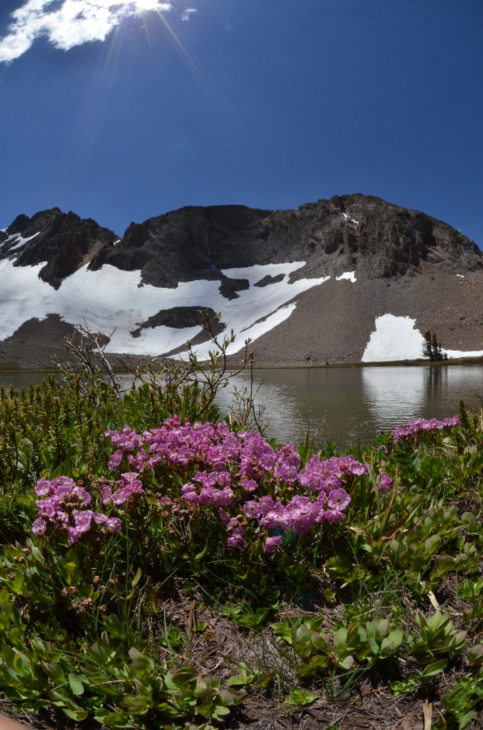
Round Top Lake and "The Sisters" with
Kalmia polifolia (swamp laurel) in the foreground.
Starting near Woods Lake, I headed south on the Lost Cabin Mine trail with my first major destination being Round Top Lake. Nestled at the base of jagged snow-draped peaks known as “the Sisters”, Round Top Lake is a small alpine lake, displaying colors from brown to baby blue to turquoise depending on one’s perspective. From the lake surface at over 9000 ft elevation to the Sister’s heights of over 10,000 ft, snow lingered only in patches, though it would possibly be much more extensive this time of year if not for the persistent California drought. The barren rock comprising the higher peaks around the lake was cracked or twisted, but also mottled with yellow and orange lichens giving the harsh rock a hint of softness. Trees were sparse at this elevation and appeared to consist only of white pines.

From the Round Top area, I descended southward into a valley of sorts, switching back and forth down the slope to Fourth of July Lake. It was about a thousand foot descent. This northern part of the Mokelumne wilderness is a popular hiking and camping destination, but despite a few signs of human impacts, the beautiful landscape was untrammeled.

Looking south into the Mokelumne Wilderness with Fourth of July Lake near center.

Erysimum sp. (wallflower).
Wildflowers were abundant throughout my hike, and at higher elevations they included bright white patches of Phlox, and stalks of wallflowers, exploding in vibrant yellow almost like little fireworks from the grey soils. On the descent down to Fourth of July Lake, plant diversity increased markedly. Delicate pink blooming Sidalcea became increasingly common and I also observed Maianthemum racemosum that appeared to have a more yellow inflorescence than I’m familiar with from the plants I recall from the Oregon Cascades.

A ring of forest surrounded Fourth of July Lake and included mountain hemlock, pines, firs and even some short alders at the water’s edge. Snowmelt fed a stream of sorts that entered the 8160 ft elevation lake from the west, and it made little waterfalls cascading down the steep granite slopes that hug the northern and western sides of the lake.

Wildlife seemed a little sparse on my hike – some birds, a few chipmunks and an unknown larger mammal that left my sight just after noticing it. There were beetles, ants, mosquitos, butterflies and tiny fish in Round Top Lake. However, plant species were plentiful (I have many new species to learn while reviewing my photographs) and the landscape was incredible.

From left to right: Sidalcea sp., assorted lichens, ridge on the far side of Summit City Creek valley.