14 August 2012

Sisters

The three snow-capped peaks of Sisters, each rising to over 10,000 ft, sit right in the middle of the Oregon Cascades. To the north are Mts. Washington and Jefferson. The Sisters peaks are home to many of the glaciers found in the state of Oregon (1). The wilderness that surrounds the three peaks was created in 1964 and is part of the Willamette and Deschutes National Forests (1). At 439 square miles, it is the second largest wilderness in Oregon (2).


South, Middle and North Sisters from the south. Photo by Lyn Topinka, USGS, summer 1985.


28 July 2012. I entered the wilderness from the Lava Camp Lake trailhead, just east of McKenzie Pass and stopped at South Mattieu Lake along the Pacific Crest Scenic Trail (PCT). Here there was essentially a ridge (Scott Pass) at about 6000 ft with the mountains dropping to the west and into the plateau of central Oregon to the east. It was a warm day, but in the evening there were now gusts of wind that started to chill me. This lake was tiny, perhaps only an acre or two in size. I took the PCT south to the western side of Yapoah Crater. The crater was a steeply-sloped and nearly barren hill of volcanic rubble. There were lava fields present throughout the northern part of the wilderness – grey in some places, rust colored in others. Firs, mountain hemlock, and pines comprised the forest at lower elevations but up near the base of Yapoah Crater (elev ~6250 ft), the trees were mostly mountain hemlock with some interspersed pines.

There were quite a few ghost trees at higher elevations in the wilderness – dead mountain hemlocks (or other species) that add an element of history to the landscape. These trees, sometimes silver with the sun low on the horizon, still stood tall but had variously broken-off limbs. Piece by piece they will decay and lend greater depth to the forest’s history. Plant life here is determined by the availability of soil. There were vast fields of barren volcanic rock inhospitable for woody species. Even then, where there was soil, the trees were small. A few herbaceous plants were in bloom – lupines and a common blue trumpet-shaped flower that hangs on in the smallest patches of soil amid the rubble. The north peak of sisters came into view at various times along the trail. A decent percentage of its slopes were still covered in snow. Mts Jefferson and Washington were easily visible to the north. There were a few tiny meadows or drying pond basins there. At one opening in the forest, dragonflies danced about in abundance. Perhaps foraging in the warm air, they would not settle for even the slightest moment so that I could get a decent photograph.


Damselfly near North Mattieu Lake.
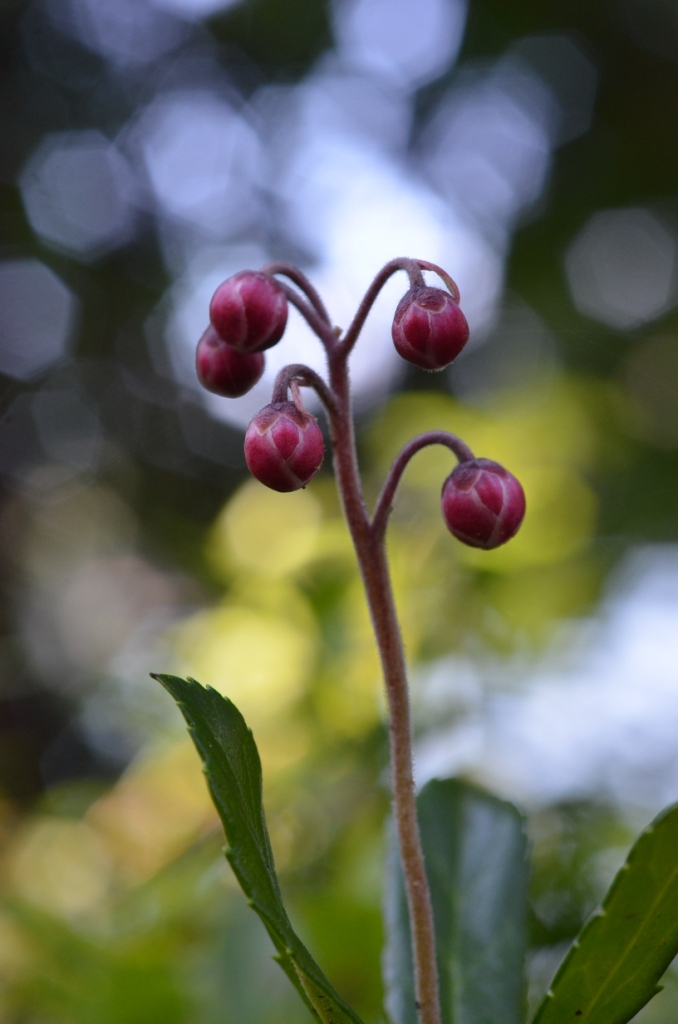


Lupines.

11 August 2012. I entered the wilderness as I did two weeks ago, but pushed further south along the PCT than before. I arrived at a wonderfully beautiful alpine meadow where the Scott Trail meets the PCT. A few channels cut through this flower-filled basin much like shallow tidal channels in an estuary. There was just a trickle of flowing water in a creek, probably sourced mostly by continuing snow melt. The meadow was sprinkled with bright pinkish-red paint brushes (Castilleja), bluish-purple lupines (Lupinus) and yellow buttercups (Ranunculus). Small sedges, mosses and rushes contributed to the low-lying carpet of vegetation in the valley. There were also extremely dwarf shrubs that appeared to be willows – such a stark contrast to the tree habit these plants have elsewhere! Even though this was a meadow for all practical purposes, I did not notice any grasses. Interestingly, in their place, other plant families have filled in the dense, but very low-lying vegetation. It would be interesting to study the effects of the annual snowfall on the plants in this ecosystem: Are most of the species annuals? How long is their growing season? Can individual plants survive many months under thick snow cover or in frozen ground?

Continuing south along the PCT, I reached the Opie Dilldock Pass area and stopped on a barren ridge of sharp cinders. At ~6800 feet elevation, I had reached a zone of snow patches. The air was very warm and the remaining snow was rapidly melting. I was now near treeline though in some places the trees extended higher than my current elevation. From this vantage point, there was a wide vista of central Oregon, obscured only by a hazy sky and the even higher peaks present to the east and south.


A 180 degree panorama of an alpine meadow at about 6300 ft elevation. North Sisters (L) is to the south.

The Cascades are a relatively young mountain range having formed starting about 7 million years ago (3). Subduction of the small Juan de Fuca plate under the North American Plate in the Pacific Northwest provides the friction that generates magma production and builds the volcanoes (4). The mountains lie in a gently curving chain from southern British Columbia to northern California. Mt. Shasta and Lassen Peak are the southernmost of the Cascades in California. Geologically, the region is very active, with many of the major mountains having erupted in the last several thousand years (5). The two northern peaks of sisters are considered dormant, but South Sister erupted as recently as 2000 years ago (1). The Cascade Volcano Observatory of the US Geologic Survey monitors volcanic activity in the region.


~270 degree panorama from Opie Dilldock Pass.

North Mattieu Lake from the PCT.

Cone of mountain hemlock, Tsuga mertensiana.


A feeding moth.

North Sisters with Castilleja in the foreground.

A small stream cut through the overlying snow to form elegant shapes.


20 May 2012

Spring blooms

Over the last month, I made two trips to Finley National Wildlife Monument in the southern Willamette Valley and two to the Cascades in central Oregon. It is a beautiful spring in the Northwest!

The refuge at Finley is a patch of protected lowland in the most urbanized region of Oregon, the Willamette Valley. A variety of habitats exist at the refuge: hardwood forest, grassland, oak savannah and freshwater wetlands. Like many federally-managed lands, some wildness persists in the refuge, but there are also unmistakable signs of human influence – non-indigenous species, buildings, roads, and bridges. And yet, these small patches of lowland habitat are sorely needed. Across the country there is so little lowland that isn’t burdened heavily by the long shadow of human land use practices. Worldwide, much of our coastal plains and broad low-lying valleys and plains have been devoured by agriculture and urbanization.


Findley was full of flowers: Iris, Claytonia, apple blossoms, Ranunculus, sedges, Camassia, Fritillaria. Here are some specimens below.


Towards the western edge of the refuge, there is a small hill at the base of which is a population of the bright perennial Castilleja levisecta, commonly known as the golden paintbrush. Natural populations of this species no longer exist in Oregon (its native range only spans the Willamette Valley to southern Vancouver Island), but some populations have been reintroduced to western Oregon. The Institute for Applied Ecology, a non-profit group based in Corvallis, Oregon, has been working with the US Fish and Wildlife Service and community volunteers to plant and monitor the species. Castilleja is a species-rich genus with which I am only a little familiar (Castilleja ambigua grows in the coastal wetlands of Oregon and I remember encountering reddish ‘paintbrushes’ a number of times in the chaparral of California).


Currently, some snow remains in the Cascades, at least above about 4000 ft. Spring blooms aren’t as abundant, but in my drives and hikes this month I came across blooming dogwood trees, Trillium ovatum, and other flowers. On one short excursion yesterday, I hiked around a pair of waterfalls along the McKenzie River near Clear Lake in the Willamette National Forest. The falls and rapids were roaring with snowmelt. I found two small populations of a beautiful orchid, Calypso bulbosa, growing under cedars on a sloping bank near the river. These plants have just a single basal leaf and a flower stalk not typically more than a few inches above the soil.


Lastly, enjoy this video of Sahalie Falls:


Reference:
Turner, M. and P. Gustafson. 2006. Wildflowers of the Pacific Northwest. Timber Press.

12 February 2012

Western pearls

The Cascades and Sierras are like a string of pearls lying from north to south along the western edge of the United States: Mt. St. Helens, Mt. Hood, Crater Lake, Mt. Shasta, Tahoe, Yosemite, Sequoia. Over the last few years I have come to love these beautiful mountains. The white peaks of the Cascades are volcanic in origin and still active: the violent eruption of Mt. St. Helens in 1980 and the bubbling sulfurous mudpots found in Lassen National Park attest to this. Many of these mountains have a beautiful conical shape, like the revered symmetry of Mt. Fuji in Japan.

Mt. Lassen in northern California is the southernmost major peak of the Cascades. But topographically at least, the mountains continue to the south with the Sierra Nevada range. The Sierras tell a different geologic story than the Cascades. Some 250 million years ago, the collision of the Pacific and North American plates melted rock that formed under the ocean in plumes (1). These structures fused. Then about 80 mya, this massive chunk of rock pushed up through the ocean floor and carried the marine sediments that had been deposited on top. Asymmetrical uplift left the eastern side of the Sierras at a higher elevation, with a more gradual decline to the west. Subsequent erosion removed much of the marine sediment, and recent glacial activity carved elegant designs into the landscape such as the world-famous Yosemite Valley.

John Muir, the poet laureate of the Sierras, termed these magnificent mountains “the range of light”. In evangelical exuberance, which Muir used without hesitation in his description of wilderness, he described a view of Yosemite in the heart of the Sierras:


“It is easier to feel than to realize, or in any way explain, Yosemite grandeur. The magnitudes of the rocks and trees and streams are so delicately harmonized they are mostly hidden. Sheer precipices three thousand feet high are fringed with tall trees growing close like grass on the brow of a lowland hill …. Waterfalls, five hundred to one or two thousand feet high, are so subordinated to the mighty cliffs over which they pour that they seem like wisps of smoke, gentle as floating clouds, though their voices fill the valley and make the rocks tremble. … The mountains, too, along the eastern sky, and the domes in front of them, and the succession of smooth rounded waves between, swelling higher, higher, with dark woods in their hollows, serene in massive exuberant bulk and beauty, tend yet more to hide the grandeur of the Yosemite temple and make it appear as a subdued subordinate feature of the vast harmonious landscape. Thus every attempt to appreciate any one feature is beaten down by the overwhelming influence of all the others.” (2).


Just before the turn of the new year this winter, we took an adventure north to south down the eastern side of these magnificent mountains. We crossed the Cascades east of Eugene and once over the crest of the range, traveled from that point forward in high country on our trip to southern California. Passing through the Cascade Range in central Oregon, I was amazed once again by the dramatic shift in vegetation on either side of the divide. Dense coniferous forests with lush green understories dominate the western slopes of the Cascades, but the forests quickly change to drier, shorter and more open canopies vegetated by pines to the east. The change in forest type is, of course, driven by differences in precipitation on the eastern and western slopes. Storm clouds moving inland from the Pacific run into the mountains and dump most of their captive water before reaching the high country.

On this trip, it snowed briefly in southern Oregon near Chemult, but the skies lightened as we moved further south towards the Oregon/California border. In Modoc County (NE California), we entered the Great Basin floristic province. Here the vegetation became desert scrub peppered with juniper trees, the largest plants on the landscape. Small patches of snow remained on the ground. Our first significant stop was Lava Beds National Monument. The short winter day was drawing to a close but we explored two of the lava caves. They were cold wide shafts filled with rubble of very bland grey and pale colors; the caves relatively gradually descended downward into the earth. We saw no bats or other wildlife in the caves, but located some small ice sculptures adhering to the rocks below. The little sculptures were shaped like hemispherical ice cream scoops, having accumulated when water dripped from the cave ceiling above and apparently froze quickly as it flowed down the mound.

Visitors in a cave at Lava Beds National Monument


The next day, further south, the highway took us near Susanville and into Nevada for a time before crossing backing into California. We arranged for a stay in the small town of Bridgeport back on the California side of the border.

On day three we learned from a highway sign that several of the roads that traverse the Sierras that are typically closed to traffic during the snowy winter months were still open at this late season. This exciting news led to a quick decision to make a detour into the eastern end of Yosemite National Park. Access to Yosemite high country by car at this time of year was a real treat since National Park records indicate that Tioga Pass had not been open this late in the winter for at least the last 31 years! (3) Already at about 7000 ft elevation in the Mono Lake area, we made it up the pass to nearly 10000 ft towing our small rented trailer. Tioga Pass is a lightly vegetated gorge of granite and snow with strong winds that move down the canyon. On the less sun-exposed places to the south and deep in the canyon, ice froze in place to form suspended white and turquoise waterfalls.

Tioga Pass


At the top of the canyon, we encountered our first alpine lake (Ellery Lake), locked frozen into the mountains at 9538 ft. Further west into the park, we explored Lembert Dome, Tuolumne Meadows and Tenaya Lake. Near Lembert Dome, we took a hike through coniferous forest to Dog Lake. Like the other alpine lakes, this one too was frozen. We walked and shoe skated over the whitish-grey ice.

Dog Lake


In the afternoon we left Yosemite, heading back down Tioga Pass onto the east side of the Sierras in time for a sunset that painted clouds and mountainsides various colors. On day four we moved further south into the Owens Valley and started to encounter classic southern California desert habitat. Tufts of dried tumbleweeds were interspersed semi-regularly on sands and rubble on the grey landscape. Perhaps their phobia for neighbors was created by intense competition underground for the sparse water available in the desert. Here the landscape was open. Expansive smooth valleys were rimmed with tall mountains. The majestic granitic Sierras, light with snow cover rose, abruptly to the west from the valley floor. 

The Sierras from Owens Valley (Mt. Whitney is in there somewhere...)


The last day of our journey took us to Death Valley National Park and further south to the metropolitan expanse of southern California. Coming up towards the park, we saw Joshua tree sentinels on the landscape. We did not proceed deep into the park, but did drive through the Panamint Valley, an utterly barren swath of land set between the Argus Mountains to the west and the Panamint Range to the east. Though not hot on that late December day, one could easily imagine the searing heat of the landscape during the death days of summer.

Notes:

1. A concise history of Sierra geology.
2. Muir, J. 1911. My First Summer in the Sierra.
3. The road was finally closed on 17 Jan 2012. See the NPS data here.

27 November 2011

05 September 2011

damsels and dragons

There is a small freshwater wetland adjacent to our new apartment in Corvallis. A very shallow creek and pool is vegetated with large hummocks of Juncus effusus and an assortment of other plants. Tiny fish were abundant, the fatter ones (maybe full of eggs) darting away from short distance advances made by the smaller ones. In the strong afternoon sun today, bluish damselflies and large dragonflies with blatant black stripes on their wings flitted about. The ones with black on the wings were perhaps the common whitetail (Libellula lydia), a widespread species in the US (Haggard and Haggard 2006). Rarely, one of the whitetails would land on a sharp shoot of Juncus, but mostly these just zipped about for some unknown purpose, neither forging nor mating being obvious aims of their activity.


Dragonflies evoke images of very pre-historic times, when the animals and plants that dominated the surface of the earth we imagine to have looked like robotic creatures suited for a harsher world, more geometric and segmented than elegant. Dragons and damsels are beautiful insects and among my favorites. Juveniles are called naiads and live in freshwater habitats; both the naiads and adults are predators (Powell and Hogue 1979, Haggard and Haggard 2006).
   
Below is a shot of a colorful damsel I found a few years ago in the California Sierras that was calm enough to allow me to get very close:


References:
Haggard P and Haggard J. 2006. Insects of the Pacific Northwest. Timber Press.
Powell JA and Hogue CL. 1979. California Insects. University of California Press.

21 August 2011

Ona Beach

We’ll soon be leaving the coast for the Willamette Valley, so I took a short trip this morning to Ona Beach, where Beaver Creek meets the Pacific Ocean.  This is a small estuary among small estuaries and is only partly under tidal influence according to the National Wetlands Inventory classification.  Nevertheless, there are some of the typical estuarine plants present right along the creek’s banks and intergrading into the sand dunes.  Here are a few pictures:
This is three square, aka Schoenoplectus americanus or Scirpus olneyi.  It seems to prefer sandy environments. In Netarts Bay along the sandy spit that separates the bay from the ocean, it grows in large monospecific patches in the low marsh.

This is Douglas’ aster, Symphyotrichum subspicatum in Latin. It is not a very dramatic plant until it is in flower.  It generally grows in upper elevations in tidal marshes.
An unknown species in the carrot family (Apiaceae).

This is a cool pattern formed by a filamentous alga (?Rhizoclonium) distributed across the sand near the outlet of Beaver Creek into the Pacific.

14 August 2011

Adventures in southern Oregon


Crater Lake is the only national park in Oregon, but it is a gem, and it is surrounded by a number of other beautiful places in the southern part of the state.  The lake (which is touted as the deepest in the United States and loved because of its extraordinary clear blue water) developed as the result of snow melt and rainfall over the ~7000 yrs since the last volcanic eruption that formed the crater holding the beautifully clear water.
This is the pumise desert at the north end of the park.
Mt Scott, on the east rim of the lake, is the highest point in the park, approaching 9,000 ft. Snow lingered in patches.
Looking westward from the ridge leading to Mt Scott.
To both the north and south of Crater Lake National Park, there are wilderness areas (Sky Lakes and Mt Thielsen) and other scenic areas.  Miller Lake is near the Mt. Thielsen wilderness.
A manzanita with Miller Lake and the Cascades in the background.
Some flowers ready to burst in pinkness!

Our final adventure lay to the north where we discoved Salt Creek Falls. It is the 2nd largest falls in Oregon and is nestled in beautiful hemlock forest.  The falls are just over the crest of the Cascades (the west side), so the forests there are very different than the east side of the mountain range.  To the east, soils are dry and pine canopies (with little understory vegetation) dominate at lower elevations.  To the west, hemlocks and Douglas firs are present, pines drop out, and there is a more lush understory including rhododendrons.
Salt Creek Falls.

31 July 2011

Dinosaur National Monument

I’ve been in coastal Oregon long enough to get very accustomed to mild temperatures, lots of rain and green everywhere.  But during the late spring I made a short trip to Dinosaur National Monument in eastern Utah.  It was comparatively warm and dry, even though apparently the state had pretty substantial levels of precipitation (snow).  Here are some pictures:
Petroglyphs

Lizards were common

A little hard to make out, but there are dinosaur vertebrae across the center of the picture.

A beautiful sego lily

25 June 2011

Yosemite III: Hetch Hetchy

The O’Shaughnessy Dam, designed to provide water for the city of San Francisco, was in place by 1923 to drown the Hetch Hetchy Valley.  Before the valley was flooded, it was apparently comparable in aesthetic effect to the Yosemite Valley, though perhaps smaller in overall dimensions.  John Muir advocated hard to prevent the construction of the dam, but political pressures won out in the end and the valley became a reservoir.

Beautiful flowers of an array of colors were present on our mid-May hike.  Perhaps someday the valley will be restored.  It would then be many decades or centuries before the effects of the dam will no longer be apparent, but what an interesting experiment in ecological succession and restoration!

30 May 2011

Yosemite II: The Falls

It has been a La Niña year, so winters in the northwest can be accompanied by higher than average precipitation. ENSO-linked precipitation trends are less clear for central California, but snowpack appears to be plentiful in the Sierras. During our visit, snow lingered in the Park above 5000 or 6000 feet elevation, though the California spring was well underway.  The numerous waterfalls around the Yosemite Valley were full, the water roaring onto the granite rocks below with a constant roar like soft thunder.  At Bridal Veil Fall there was so much water mixed into the air that the immediate area at the base of the waterfall had its own microclimate of soft rain.  In fact, up to about a half mile away from the falls, I could still feel the moisture in the air.  Vernal Fall, up the Little Yosemite Valley, presented a similar scenario.  Here the Mist Trail follows the southern bank of the Merced River from Yosemite Valley right up to the waterfall.  The trail then is composed of a long series of steep steps cut into rocky terrain leads hikers up behind Vernal Fall.  Here again, the volume of water was sufficient to greet visitors with a soft rain and make the steep granite staircase more dangerous.  I captured a beautiful rainbow made possible by the saturated air:

The upper and lower Yosemite Falls, together presenting a tremendous drop in water of over 2400 ft is probably the most impressive of Yosemite’s waterfalls to most visitors.  According to signage at the park, it is the tallest waterfall in the United States and fifth tallest in the world.  No doubt these waterfalls are beautiful and impressive.  I also enjoy smaller, more intimate, waterfalls.  At these waterfalls there is often opportunity to observe more closely the small moisture-loving biota like mosses and ferns that cling to life on the surface or cracks of bedrock.
Upper Yosemite Fall
Bridal Veil Fall


Staircase Falls


Nevada Fall

29 May 2011

Yosemite I: Dimensions

Hoping to find some real spring weather in California, we left Oregon for a week of adventures down south.  This was our second visit to Yosemite; our first was during late November a year and a half ago.  Yosemite National Park is impressive partly because of its size.  Many of the natural features are of majestic dimensions in the park, from the numerous waterfalls to the granite precipices that form the walls of Yosemite Valley to the ancient giant sequoias in the park’s three groves.  It seems that everyone should leave impressed by these larger monuments of geologic forces and biological wonder.


The wonderful thing about nature in general is that beauty is present from the largest monuments of natural forces down to the smallest scales visible to the human eye.  Yosemite most impressively illustrates this principle.  Stately Pacific dogwoods and conifers are juxtaposed with both immense grey granite cliffs and soft blankets of small mosses and lichens on rocks.  There are cloud patterns in the sky, tree patterns on mountainsides, and rich patterns of bark ridges and valleys on the trunk of a single pine tree. From big to small, Yosemite is a treasure.

14 May 2011

Uncertainty

Human life can be a cyclone of uncertainty at times.  Uncertainty, stochasticity and complexity are inherent in nature.  For us in our structured society, uncertainty can seem like the enemy.  But it is not. The enemy is our fear of uncertainty.  After a cyclone passes through a forest, a new generation of trees is always ready to spring forth.

01 May 2011

Frogs and the sweet stench of swamp

It seems that there are not usually too many places on managed public lands where visitors are free to wade through a wetland.  Today I had the opportunity to get the boots wet and muddy in a coastal freshwater wetland at Beaver Creek State Park where a short dedicated trails runs right through swamp sans the usual catwalks. 


The wetland occupies the bottom of a valley extending from the coast to several miles inland.  The valley is sparsely populated with surrounding hillsides wooded with alder and conifers.  The abundance of alders suggests that the area had been logged at some point in the past.  The marsh as a whole itself appears to be largely dominated by at least 5 species of wetland plants: cattail (Typha latifolia), spikerush (Eleocharis), the invasive reed canary grass (Phalaris) and two species of Carex.   Other species appeared to include Potentilla anserina, bright yellow skunk cabbages, twinberry, trefoil, some grasses and Juncus
Like other marshes I have been in, disturbance of the water logged soil exposed the strong smell of anoxia.  This marsh was interesting too in that the ground was very spongy in some locations.  A few birds, some dancing insects, and skittish brown frogs constituted most of the fauna I observed.