25 September 2015

Shaw Island

The Salish Sea, including Puget Sound, was carved by glaciers during past ice ages. When sea-level began rising about 10,000 years ago, it left a maze of channels and islands in central and northern Washington. The San Juan Islands are nestled between Vancouver Island to the west and mainland Washington to the east. There is regular ferry service to four of the islands – San Juan, Orcas, Shaw and Lopez – and of these, Shaw is the least populated and developed.

I arrived yesterday morning on Shaw and made my way to Indian Cove on the south side of the Island. This county park (where I also camped last night), is about the only official place to launch a boat since the vast majority of the island is privately owned. I paddled for about two hours around the east and northeast ends of Shaw to Blind Island, a tiny rock at the north end of Blind Bay and south side of Harney Channel.

Shaw Island in northern Washington state.

Blind Island is along a “marine trail” and boaters can pitch a tent there for a modest fee. The island is mostly grass and rock and weeds (unfortunately some non-natives like English Ivy are established there), but I found about 5 tree species including madrone, douglas fir, grand fir, and apples. It was a surprise to see apple trees; perhaps a resident of Shaw tried to establish an orchard here in the past.

The return paddle was another 2-3 hours and I explored the eastern shore of Canoe Island for a time. It was between Shaw and Canoe Islands that I saw the most developed bull kelp forests of the day. With a single unbranched stipe, these annual kelps reach the waters surface where their deep brown blades spread out to gather sunlight. Along my paddling route, I saw a variety of wildlife, though it wasn’t possible to capture all on camera – a bald eagle, many other birds, curious harbor seals, river otters (!) and a dolphin. 

Skittish river otters at the edge of the water southwest of Indian Cove. From my boat it was difficult to see these
otters under the dark overhanging rocks and trees, but with my telephoto lens this shot came out great!

A great blue heron standing on a raft of bull kelps near Shaw.
Just after setting up camp yesterday evening back on the south shore of Shaw, the rains came and continued a bit into the morning. There was a so-so low tide early in the day, so I walked out to Reefnet Point on the south end of the Shaw to observe the intertidal. Only a few species of seaweeds were common, and of these, Fucus and Ulva comprised most of algal cover along the rocks. In the shallow and fairly murky water, however, I found a variety of interesting invertebrates: cancer and other crabs, shrimp, anemones and one or two species of holothuroideans (sea cucumbers).


With limited places to explore (so much of the island is private property), I’m not sure I’m likely to visit Shaw again in the near future, but being at the center of the archipelago, it is a good starting point for kayaking adventures to other islands in all directions. And, aside from the occasional noise of airplanes, ferries or other sources, the island was very quiet, a great location for solitude.

A madrone hanging over the water on the northwest shore of Shaw Island.


22 September 2015

Sauvie Island

It was a gorgeous weekend in the Pacific Northwest, the time of year when the warmth of late summer lingers but the first signs of fall appear: yellowing maple leaves, a sky full of cumulus clouds and a few raindrops. 

The Columbia River, third largest river in the US, is one of the iconic symbols of the Northwest. Yet despite living in Oregon for four years until recently, I’ve really spent little time exploring it. I had a free afternoon on Sunday, and a boat, and was in Portland, so off to explore the Columbia it was.

Seagulls over the Columbia River. Sauvie Island in Oregon is to the left; Washington State is to the right.

The northern end of Sauvie Island with approximate
 locations where jumping fish were observed. USGS Topo.
If the signs are to be believed, Sauvie Island is the largest riverine island in the nation (Oregon seems to have a penchant for pointing out superlative natural landmarks, an example being the ‘D River’ on the central coast, which is apparently the “nation’s shortest river” or something like that). Sauvie Island is located just northwest of where the Willamette River meets the Columbia, and it is large indeed: large expanses of farms and woodland protected by levees, and miles of roads throughout the island connected to the Oregon mainland by a single bridge. The northern part of the island is a state wildlife reserve. It was there that I launched the kayak on the western bank of the river.

The afternoon was calm and virtually all of the chop to contend with in the kayak was generated by the frequent passing of motorboats. I paddled perhaps a few miles north along the river, staying close to the shore, and finally rounded the tip of the island turning south into the Multnomah Channel. The island shoreline alternated between sand and firm mud; the upland was vegetated with deciduous trees, shrubs and some late season wildflowers.

A perched blue heron.


The highlight? Definitely fish jumps. I unexpectedly caught the first, a large salmon perhaps a hundred meters away that flopped a half meter into the air to crash back into the cool river. Over the next couple hours of rowing I saw (or heard) several more splashes, the fish leaping to catch an insect meal or tease the fisherman on the river. Their infrequent leaps and splashes lasted just a second, a real challenge for anyone trying to record the action. 
This is the most luck I had catching a shot of jumping fish. 


Algae and vascular plants at the shore of Sauvie Island. The sedge at right is so cool, but I have not yet tried to identify it.

13 September 2015

The west is ablaze

Much of the western United States has been on fire this summer. Affected landscapes range from California chaparral to temperate rainforest in the Pacific Northwest. Fire danger appears to be elevated this year because of the convergence of a few important factors. First, much of the western US (but particularly California) has been experiencing severe drought over the last few years. Second, climate change continues to steadily result in higher land temperatures year over year. And finally, western forests have been subject to a long history of fire suppression by management agencies that have left more fuel than would otherwise be present.

Fire is a natural part of some ecosystems. In fact, certain plant species are dependent on fire for establishment of juveniles or completion of their life cycle. Examples include many species of pines and the giant sequoia of the Sierra Nevada. The latter species requires high light and fires help clear out competitors that might shade young sequoias.

Stebbins Cold Canyon Reserve in spring 2014 with
pine, oak and chaparral habitat.
Unfortunately, fire management policies have exacerbated the threat of large intense fires in the west. During the early decades of the 1900s, fire was suppressed at all costs. In some cases this may have led to the excessive buildup of fuels in dense forests. Once the importance of fire to some native ecosystems began to be better understood, land management agencies such as the US Forest Service recognized the importance of allowing some fires to run their course. Despite this change in attitude about fires in western ecosystems, fires are still managed in many cases. Continued encroachment of human development deeper into forests or other wildlands increases the likelihood that a fire will need to be suppressed to protect human infrastructure instead of letting it runs its natural course.

The Wragg fire was a moderate sized fire that ignited earlier this summer and burned through chaparral and pine forest habitat along state route 128 in the coast range hills of northern California near Lake Berryessa. The fire consumed the whole area of the Stebbins Cold Canyon Reserve, a small University of California research reserve where I have been hiking several times over the last decade.

Stebbins Cold Canyon Reserve protects a north-south oriented canyon in the hills of the northern California coast range. It is an example of relatively dry coast range habitat, with a mixture of chaparral and oak and pine woodland. The valley floor has a small creek with riparian habitat and the valley slopes are spotted with oaks and pines and manzanitas.

My most recent hike at the reserve was during April 2014. Monkeyflowers, Brodiaea, Castilleja and Dichelostemma were in bloom at the time. The most striking plant I observed was the heartleaf milkweed, Asclepias cordifolia. Emerging stoutly a half meter or so from the short groundcover of grasses, it had slate green fleshy opposite leaves and bright purple flowers. The magenta petals were slightly reflexed (bent backwards) and contrasted vividly with white hoods that form little loops around the center of the flower.

Habit and flowers of Asclepias cordifolia, heartleaf milkweed, spring 2014.

Cold Canyon in late August 2015, after the Wragg fire.
The Wragg fire however, transformed the landscape dramatically this summer. Although the Reserve is currently closed to visitors, from the highway it is possible to see the scorched hillsides. The ground was blackened and trees stood like ruins on the hillside. Looking closely, I could see that not all vegetation was equally affected; many trees had at least some green in their canopies, suggesting tree damage, but not complete mortality. Of course, the soil retains a seed bank and perhaps individuals of some species escaped mortality if the fire moved quickly through an area. It will be very fascinating over the next few years to hike the trails again and observe how the ecosystem recovers.


References

- Eckenwalder JE. 2009. Conifers of the World. Timber Press, Portland.
- Forest History Society. U.S.Forest Service Fire Suppression.
- Harvey HT. 1978. The sequoias of Yosemite National Park. Yosemite Association, Yosemite National Park, CA, 36 pp.

23 August 2015

Nudibranchs

Rocky intertidal habitats can burst with color. In Pacific tidepools, among the most colorful organisms are beautiful sea slugs, or nudibranchs. They are roughly similar in size to their shell-less cousins on land, but they are not at all drab like terrestrial slugs.

Scientifically, nudibranchs are classified in an order (Nudibranchia) within a subclass of mollusks known as the opisthobranchs. There are several other groups of opisthobranchs, including sea hares. The nudibranchs themselves are divided into a few groups. The most common are dorid nudibranchs, which have a tuft of gills on the top of the body midway, or towards the posterior end of the animal. Another group, the aeolid nudibranchs, is showy, having rows of protrusions (cerata) along the top of the body. While many molluscs have hard shells for protection (clams and limpets for example), the sea slugs do without. The nudibranchs are predators, feeding on other invertebrates and sometimes on other nudibranchs. Their bright colors may serve as a warning to potential predators that might be tempted to eat these soft-bodied morsels.

Hermissenda crassicornis, an aeolid nudibranch, from Greyhound Rock, Santa Cruz Co, CA, June 2015.
With such delicate bodies, it is a wonder that sea slugs can survive on wave-pounded coasts. Clinging to seaweeds in calm pools at low tide, within a few short hours, the rising tide will bring crashing waves and turbulence. Other intertidal invertebrates – mussels, limpets, chitons and barnacles for example – cling with great tenacity to intertidal rocks to withstand strong hydrologic forces within their environment. The marine algae have a different strategy: they typically have flexible branches or stipes that allow them to be passively whipped back and forth as waves rush over them. How do the delicate nudibranchs make it? Do they retreat into refuges among the rocks when hydrologic chaos is at its greatest?
Triopha catalinea, a dorid nudibranch, at Greyhound Rock. 

I’ve seen quite a few nudibranchs on intertidal trips this year to the central California coast. For example, during a very brief stop at Greyhound Rock in northern Santa Cruz County in June I found four different species in the low intertidal. The most colorful was a single individual of Triopha catalinae, a few centimeters long. Clinging to a strand of feather boa kelp (Egregia menziesii) right at the water’s surface, the milky white body punctuated with bright orange spots was a striking contrast with the chocolate brown kelp below.

One of the most common nudibranch species this year has been the distinctive Okenia rosacea, or Hopkin’s rose. I found close to a dozen animals in just a half hour of tidepooling at Greyhound Rock. In fact, I’ve seen this species on many of the intertidal trips I took this spring in California: Pigeon Point in San Mateo County, Glass Beach in Mendocino County, and at Sand Dollar and Mill Creek in Big Sur. Essentially a hot pink mess of slug, there is nothing quite like it on the coast and you can’t miss it!

Okenia rosacea (formerly known as Hopkinsia rosacea) from Pigeon Point,
San Mateo County, CA, October 2009.


References

Behrens DW. 1991. Pacific Coast Nudibranchs. Sea Challengers, Monterey, CA.
 ...also, check out the Sea SlugForum

17 August 2015

Hunting heron

Duxbury Reef is a low-relief intertidal bench at the west end of Bolinas Bay in Marin County in northern California. Tidal seaweeds and invertebrates live in a matrix of cobbles and silty sand which left the water rather murky – more like an estuary than the outer California coast. It seems like the unusual substrate of this site limits algal diversity and results in a fairly unique community. Several parallel ridges of bedrock provide some rare additional relief that hosts more typical mid-intertidal species like rockweeds and mussels.

Birds were actually the highlight of my low tide visit earlier this month to the reef. Unnerved by my presence, a great blue heron hunted in the shallow water with the rising tide. I crouched and observed for some time, witnessing at least two successful hunts of intertidal fish. The bird’s patience was obvious, but they must have remarkable eyesight to see fish which are probably well hidden in the dark tidepools.


13 July 2015

Summer showers in the Ventana Wilderness

This month I completed my fourth backpacking trip to the Ventana Wilderness along the Big Sur coast. Actually, my first visit to Ventana some 16 years ago was my first backpacking trip ever*, a fun adventure with friends right after college. This time, like before, I traveled via the popular Pine Ridge Trail from Big Sur Station east into the wilderness. I originally intended to travel no more than the 7-8 miles to the campground at Barlow Flat, but decided en route to go an extra couple miles to Sykes, a popular destination because of its hot springs. Starting at Pfeiffer Big Sur State Park, the trail ascends and descends along the northern slope of several mountains in the Santa Lucia Range, running roughly paralleling the Big Sur River.

A south-facing slope north of the Big Sur
River. Mountain valleys, with their more
mesic soils, support populations of red-
wood, Sequoia sempervirens.
The Ventana Wilderness is located in the northern part of the Los Padres National Forest, south of Monterey on the Big Sur coast. Big Sur is of course world renown for its dramatic coastline, where mountains several thousand feet in height immediately hug the Pacific coast. The result is spectacular views of a vast Pacific expanse that transitions from turquoise near shore to deeper blue offshore. The marine influence creeps onshore when the coastal valleys fill with fog, but the higher mountain ridges and valleys farther inland are dry and warm.  

Vegetation along the Pine Ridge Trail alternates between chaparral, oak woodland, and redwood forest. The drier hillsides and ridges tend to support chaparral, while the river valleys and folds between mountains contain redwoods which are dependent on the coastal fog. Madrone, with its beautiful red bark (often peeling back from the trunk in curls) was common throughout my hike.

Tiger lily!
At the floor of the valley below the Pine Ridge trail runs the Big Sur River, which has never seemed to have much water during my visits. This month, flows were likely reduced even further because of the lingering drought in California. The valley floor is a pleasant corridor of riparian habitat with trees such as redwood, alder, sycamores, and oaks. The river is also a corridor for one of my favorite flowers – the tiger lily. I found several blooming along the river, the beautiful orange flowers pendant like small decorative lanterns lighting up the shaded valley.
Adiantum jordanii, a maidenhair fern.

The hillslopes of Ventana were covered in poison oak, and a week and a half later I can thankfully say that I did have a reaction to its menacing oils, even though I brushed against the plant a few times in 20+ miles of hiking. On the drier slopes, flowers included orange monkey flowers, red columbines, and some paintbrushes. For relatively dry habitat, there were also quite a few ferns. There were two or more species of maidenhair ferns, Pityrogramma, and other species.

One of the species I paid more attention to on this trip was the California bay, Umbellularia californica, a mid-sized tree that was relatively common throughout my wanderings. Snapping the leaves emitted a strong aroma. Umbellularia belongs to the Magnoliids, a group of flowering plants believed to be among the more primitive of all angiosperms. It is classified in the Laurel family, Lauraceae, that also includes Cinnamomum the host of our spice cinnamon.

Umbelullaria californica, the aromatic "California Laurel" or "California Bay".

Madrone leaf and its collection of water
droplets after a day-time summer shower.
My initial hike up the Pine Ridge Trail felt very humid and the midday sun turned to cloud cover and then eventually to a half hour or so of rain showers, even moderately heavy at one point. This was a refreshing change for the usual dry California summer. It brought back memories of a backpacking trip here years ago in late June when a daytime summer storm was also accompanied by lightning. We were evacuated from the wilderness early the next morning when it turned out that one of the lightning strikes started a fire. Later named the Basin Fire, it became one of the largest fires in recent history in California. This year, fire scars were evident, but not particularly abundant.

The Ventana gets heavy use, but it is one of the few wilderness areas situated right along the Pacific Coast of the lower 48 states. For the diversity of plant life, close proximity of varied habitats, and a chance to see redwoods near the very southern end of their range, it is certainly worth a visit.

Redwood sorrel, Oxalis, a common herb of the redwood understory. The plants at left were in the shade; those at right had folded to minimize exposure to direct sun.


*In the intervening years, I have definitely learned to travel lighter on overnight trips (though camera lenses and books are a constant temptation). On this first trip I probably had a pack that weighed some 50-55 lb, the culprits being a heavy book, at least one canned food item, a steak (yum) and other gear.

Reference: Baldwin BG et al. 2012. The Jepson Manual. Vascular Plants of California, 2nd ed. UC Press, Berkeley, CA.

30 June 2015

Mokelumne II

Un-opened flower of columbine, Aquilegia
formosa
. This species was common along
the south shore of Caples Lake.
In my last post, I wrote about my trip to Round Top and Forth of July Lakes in the northern part of the Mokelumne Wilderness. A perfect time for exploring the high Sierra, I planned another visit. The following week I took my oldest son and returned to explore the Emigrant Lake trail, also in the northern part of the wilderness.

We started at the western point of Caples Lake and followed the southern shore of the lake under relatively dense tree cover. After about 3 km, the trail left Caples Lake to turn southward, and the trail began to climb in elevation. It roughly followed Emigrant Creek, a very small creek connecting Emigrant Lake with Caples Lake. Ascending towards Emigrant Lake there were a few small beautiful meadows, one in particular was a sea of waist-high bright green corn lilies, not yet in flower.

The sky was clear but the wind blew in strong gusts at Emigrant Lake where the trail ended. Like the lakes I visited last week, Emigrant Lake sits at the base of an arc of grey rock and snow. Ben and I climbed a few hundred feet up to a ridge from the eastern shore and had a great view of Emigrant Lake to the west and Caples Lake to the north. Overall I found some plant species not observed on my earlier trip. Here is a sampling:

Three species of Castilleja.
Frasera sp. I only found one individual of this species, but its large stature and very interesting flowers made it stand out.
Wyethia, or "mule's ears". This plant was common.
Calochortus. I only saw two individuals of this genus, both growing on a
relatively rocky, sun-exposed slope near Caples Lake.

Pectiantia breweri. This rather unassuming plant has the most incredible flowers
on close inspection. In the close-up photo to the right look for the five yellowish
petals. Each has pinnate branches to give the whole flower a web-like appearance.


14 June 2015

Mokelumne Wilderness

Sierra Nevada wilderness areas in eastern
California. Map from www.sierrawild.gov.
The Sierras boast a string of wilderness areas from Desolation and Granite Chief near Lake Tahoe to Yosemite and Ansel Adams in the central Sierra to a constellation of smaller wildernesses in the south Sierra. I have not visited most of these, but yesterday I did a day hike in the Mokelumne Wilderness that intersects three national forests just south of Lake Tahoe. It was gorgeous.

Round Top Lake and "The Sisters" with
Kalmia polifolia (swamp laurel) in the foreground.
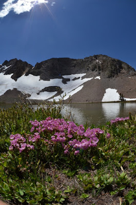
Starting near Woods Lake, I headed south on the Lost Cabin Mine trail with my first major destination being Round Top Lake. Nestled at the base of jagged snow-draped peaks known as “the Sisters”, Round Top Lake is a small alpine lake, displaying colors from brown to baby blue to turquoise depending on one’s perspective. From the lake surface at over 9000 ft elevation to the Sister’s heights of over 10,000 ft, snow lingered only in patches, though it would possibly be much more extensive this time of year if not for the persistent California drought. The barren rock comprising the higher peaks around the lake was cracked or twisted, but also mottled with yellow and orange lichens giving the harsh rock a hint of softness. Trees were sparse at this elevation and appeared to consist only of white pines.

From the Round Top area, I descended southward into a valley of sorts, switching back and forth down the slope to Fourth of July Lake. It was about a thousand foot descent. This northern part of the Mokelumne wilderness is a popular hiking and camping destination, but despite a few signs of human impacts, the beautiful landscape was untrammeled.

Looking south into the Mokelumne Wilderness with Fourth of July Lake near center.

Erysimum sp. (wallflower).
Wildflowers were abundant throughout my hike, and at higher elevations they included bright white patches of Phlox, and stalks of wallflowers, exploding in vibrant yellow almost like little fireworks from the grey soils. On the descent down to Fourth of July Lake, plant diversity increased markedly. Delicate pink blooming Sidalcea became increasingly common and I also observed Maianthemum racemosum that appeared to have a more yellow inflorescence than I’m familiar with from the plants I recall from the Oregon Cascades.

A ring of forest surrounded Fourth of July Lake and included mountain hemlock, pines, firs and even some short alders at the water’s edge. Snowmelt fed a stream of sorts that entered the 8160 ft elevation lake from the west, and it made little waterfalls cascading down the steep granite slopes that hug the northern and western sides of the lake.

Wildlife seemed a little sparse on my hike – some birds, a few chipmunks and an unknown larger mammal that left my sight just after noticing it. There were beetles, ants, mosquitos, butterflies and tiny fish in Round Top Lake. However, plant species were plentiful (I have many new species to learn while reviewing my photographs) and the landscape was incredible.

From left to right: Sidalcea sp., assorted lichens, ridge on the far side of Summit City Creek valley.


21 May 2015

Whales!

Big Sur is one of my absolute favorite places. I don’t visit frequently enough. Being there rejuvenates my passion for exploration and for wilderness. And though it has perhaps become more crowded over the years, one can still find relative quiet and a chance to be absorbed by the immensity of this rugged and beautiful place.

With my two youngest kids I took a day off work to camp and tidepool over an extended weekend. Long sunny days and cool temperatures – the weather was perfect.

We camped at Plaskett Creek, a small US Forest Service campsite just east of California highway 1 in the southern stretch of Big Sur. Given that the low tide was very early the next morning, it made for convenient tidepooling at nearby Sand Dollar Beach. The site is a wide sandy cove, buttressed along the whole shoreline by bluffs, except for a single point of access via a stairwell at the southern third of the cove. There are rocky intertidal areas at the northern and southern ends of the sandy beach.

Sand Dollar Beach
The encrusting sponge,
Haliclona.
On any visit to the coastal rocks my eye is trained for seaweeds, but my most significant impression of the intertidal biota on this visit was the abundance of Phragmatopoma californica, an annelid worm that constructs intricate dwellings of sand at the edge of intertidal rocks much like a marine beehive. The colonies seemed to be quite abundant, challenging my memory of whether they were so common on my visit to this same site years ago.

Returning to the plants, steel grey-green Porphyra were common on rocks in the high intertidal zone and from the mid-intertidal down there were rich coverings of seaweeds. Small individuals of giant kelp, Macrocystis pyrifera, were frequent in the lower intertidal and I also found about three small bull kelp sporophytes.

Bands of the light brown Phragmatopoma colonies lining intertidal rocks.
One of the treats of the long drive along the Big Sur coast was spotting 4 grey whales – three near Willow Creek (a beach access point near the outpost of Gorda) and one farther north. The group of three swam together close to the rocky shore for quite some time, surfacing briefly perhaps every minute or so. Their dark grey mottled backs would appear at the surface, or sometimes a lone flipper would poke into the air. They frequently swam close together, at some points appearing a pair appeared to be nestled together.

Grey whales, now mostly only a northeast Pacific species, migrate annually between Baja California and Alaska. These animals, the loitering in Big Sur aside (I can’t blame them), were probably on their way north. Today there are perhaps about 20,000 animals along the west coast of North America, so the chance to observe several on our trip was fantastic. 

A trio of grey whales surfacing together.
We also saw sundry other marine mammals.
Macrocystis pyrifera, giant kelp.
Fucus distichus, Silvetia compressa and various red seaweeds on intertidal rocks.

18 April 2015

Middle Fork American River

Sometimes gems lie close to home. I’ve passed through the town of Auburn, California quite a few times, but rarely have ventured off to explore the area with its distinctive red soils. Auburn is just northeast of Sacramento, a gateway to the low elevation foothills of the Sierra Nevada.

Yesterday for a rare day off work, I went hiking in the Auburn State Recreation Area with a close friend. We hiked and scrambled among rocks along the middle fork of the American River, an untamed Sierra river of rapids, sand and gravel bars, and crisp cool waters flowing through steep forested hills. Given the worsening drought in California, I imagine the flow may have been low compared to historic levels.

Bedrock, boulders and cobbles of various sizes were littered among the river basin, much of the bedrock having a greenish serpentine hue and smooth undulations from centuries of erosive forces. Milky white quartz could be found as smooth stones in the river bed or as white veins that sharply interrupted the darker bedrock. At a shady spot at the edge of a river - a lunchspot - a large yellow-brown banana slug slowly meandered up a huge vertical rock face. With no vegetation nearby, it seemed off course for finding a food or mate.

The steep south-facing hill slopes along the river were covered in abundant flowers, especially blue lupines and California poppies, their brilliant orange petals consistently smaller here than in other grasslands or gardens. I found milkweeds and a white species of Castilleja too. Butterflies were abundant and included a large yellow but black-striped species, and a black shimmering species. They wouldn't sit still long enough to be photographed except at a large blooming tree where they congregated in abundance.