Showing posts with label Cascades. Show all posts

06 July 2017

Paradise

Mt. Rainier from the east.
The luminous peak of Mt. Rainier is omnipresent in central Washington, visible near Olympia, looming in the east from Seattle, and touching the western horizon from the edge of the desert of central Washington. At over 14,400 feet, it is the highest member of the Cascade Range and dwarfs the nearby mountains.

For my second visit to Mt. Rainier National Park, we camped for two nights at Ohanapecosh, a low elevation campsite in the southeast corner of the park. The afternoon we arrived we detoured to a short trail starting at the White River campsite on the road to Sunrise. A trail ascended from dense forest near the campsite and followed the frigid turbulent water of the White River. The Emmons Moraine Trial branched towards the south, crossing the White River with a narrow footbridge constructed of a single log. The water jumbled over boulders in such a rush that spray danced into the air. Across the river the trail continued upward along a ridge that overlooked the terminus of Emmons Glacier and its moraine. This valley to the south was barren higher up (perhaps old ground the glacier used to occupy), forested with short trees farther down, and adorned with a beautiful turquoise lake farther still. The lake wasn’t on any map I had seen of the park. I learned that Emmons Glacier is the largest glacier in the lower 48 states.

Left: Unnamed alpine lake near the White River. Right: White River and Emmons Glacier.

On the south slopes of Rainier lies Paradise, a popular stopping point and gateway to the snowy alpine. On the second morning I set out with my two oldest to wander up the slopes of Paradise looking for wildflowers. Most of the Skyline Trail area was still under snow. In street shoes, we were not well prepared, but we hiked on the firm snow anyway, gaining enough elevation to have excellent views of Mt. Saint Helens and Mt. Adams to the south.

Glacier (Nisqually Glacier I believe) on the
south slope of Mt. Rainier visible from Paradise.
When we started the hike most of the bright slopes of Rainier were still visible, framed by a deep blue sky. A few clouds tightly hugged the mountain near the summit, wisping off the east side of the peak. A large patch of grayish white clouds quickly moved in and obscured the top of the mountain. Nisqually Glacier, when it was visible, was a ribbon of ice streaming downslope from near the summit, cracked and shining aquamarine light in places.

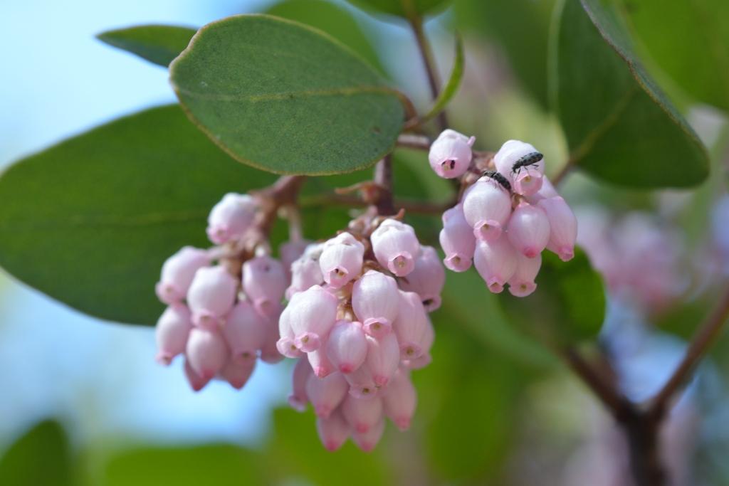
Up to an elevation a little above the visitor’s center there were meadows of yellow alpine lilies (Erythronium grandiflorum) and white avalanche lilies (E. montanum), each species generally clustering together with its own. At somewhat higher elevations however, the main flowering species changed to Trollius laxus (American globeflower), paintbrushes, and pink-flowered alpine shrubs where snow was not covering the ground. Chipmunks scurried about; marmots foraged more casually, largely ignoring hikers crisscrossing the snow trying to follow some semblance of trails. Lines of backpackers with ice axes, helmets, and better footware streamed by us headed for the pure white drifts of snow and ice above.


References


Turner M, Gustafson P. 2006. Wildflowers of the Pacific Northwest. Timber Press, Portland, OR.

Cascade Range peaks visible from the southern slope of Mt. Rainier. Left: Mt. Adams. Right: Mt. Saint Helens.
Paradise mammals. Left: Marmot. Right: Chipmunk bounding across a snowfield.
Firs on the slopes at Paradise.
American globeflower. 

14 August 2016

Thornton Lakes, North Cascades National Park

The northern Cascades, looking south from the Thornton Lakes area.
2016 is the centennial year of the National Park Service, and with an annual pass in possession, I’m making some effort to visit parks wherever I can this year. Ideally, I’d have the luxury of a whole summer off to explore parks throughout the west, but such an extended vacation isn’t feasible.

I did have two weeks off to travel to the Pacific Northwest in July and the last wilderness stop I made was North Cascades National Park in northern Washington. It was a first time visit for me, as was Mt. Rainier in central Washington earlier that week. North Cascades encompasses two areas – a northern section of the park which extends to the Canadian border and a southern area bordered by two national forests and Lake Chelan National Recreation Area. Ross Lake National Recreation Area bisects the two park units, and is generally the gateway to the whole region. Almost all points of access to the National Park itself are by foot trail; in fact, there are only two dirt roads that lead anywhere directly into the park. Most of the park is also part of the Stephen Mather Wilderness.

The southern-most of the Thornton Lakes.
The terrain is rugged – forest, exposed rock at higher elevations, and many glaciers. The park has over 300 glaciers, a large fraction of all those found in the lower 48 states. Using aerial photography and measurements at several glaciers, researchers have been assessing their rates of change. Like other montane regions, the apparent effects of climate change are alarming: at North Cascades, total glacier area is estimated to have declined by about 40% since the mid 1800s.

I hiked into the park along the trail that leads to Thornton Lakes in the northern unit. The first 3 kilometers or so beyond the trailhead, there was little ascent as the trail went north and then south following the contour of a valley through mid-elevation forest. Thereafter it turned north again, but with significant elevation gain up the slope of the mountain. It was a challenging day hike, finally terminating on the eastern flank of a basin that held the southernmost of the lakes. From this relatively high vantage point, I could see the snow-capped peaks to the south, probably in the southern unit of the park.

The slopes of the lake basin were steep and a creek tumbled into the north end of the lake off in the distance. The trail down to the lake was likewise steep and I only went down partway, not reaching the lake. From the distance, however, I could see a constant stream of concentric ripples radiating out over the water’s surface. Perhaps fish were rising periodically to the surface to feed on insects.

Ripples on the lake.

One day hike of course was only a tiny sampling of this large and seemingly spectacular part of the Cascade Range. I look forward to another chance to hike or backpack into this rugged and remote wilderness.

References

National Park Service. Undated. North Cascades National Park map.

National Park Service, North Cascades National Park website.

31 July 2016

Snow Lake, Mt. Rainier National Park

Snow lake, the southern end.
Alpine lakes are one of my favorite destinations in the mountain wildernesses of the Pacific states. At higher altitudes the water almost invariably reflects beautiful hues of blue, turquoise, yellow or some other color. The lake margins are usually lined with small wetlands or edge up against beautiful coniferous forests with tall spires of stately trees. Dragonflies and damselflies might dart to and fro while water striders balance on the surface tension of the water. In winter and spring ice blankets the lakes while they quietly sleep through the cold months.

After an evening hike to Comet Falls and a night of camping on the slopes of Mt. Rainier, the next day we set out to see a few other regions of the park. We stopped to see the meadows of lilies (and unexpectedly, the marmots!) at Paradise midday and then drove farther east into the park for a relatively short hike up to Snow Lake. Snow Lake is tucked into a basin at the base of a semi-circular rocky ridge that is part of the Tatoosh Range. The lake is sort of sickle-shaped. After a short jaunt beyond the end of the official trail, one reaches the southern end of the lake where brick orange soils stand out distinctly on the lake bottom.


Map of Mt. Rainier National Park at left (from NPS, 2015), and inset at right with
Snow Lake (from USGS, 1971).


Mt. Rainier from the Snow Lake trail as the sky clears after an early
summer storm.

For the first 24 hours of our visit to the park, Mt. Rainier was shrouded in clouds since a storm that had overtaken the Pacific Northwest that weekend in early July was still lingering. However, the clear skies of summer were returning and on the return hike from Snow Lake back to the trailhead, the clouds shrouding the mountain began to clear and the beaming rugged glaciers of Rainier’s south slopes became visible.

Mt. Rainier is the highest of all the Cascade peaks in Washington, Oregon and California, topping Mt. Shasta by a few hundred feet. Its magnificent slopes culminate in snowfields and cracked glaciers. It is a remarkable beacon in central Washington and I hope to visit again soon to explore all the gems it has to offer: rivers, forests, lakes, waterfalls, and ice!

Reference

Turner M, Gustafson P. 2006. Wildflowers of the Pacific Northwest. Timber Press, Portland, OR

Snow and ice on the southeastern slope of Mt. Rainier. 
White torches of blooming bear grass, Xerophyllum tenax
(Liliaceae).

White rhododendron (Rhododendron albiflorum) at left and avalanche lily
(Erythronium montanum) at right.


04 October 2015

Crater Lake

Crater Lake National Park was the last significant stop on my recent trip to the Pacific Northwest. Located about 50 miles north of the California border, it is the only national park in Oregon. The park centers on the magnificent lake with its deep, cold, and intensely blue waters.

Crater Lake and Wizard Island (center) from the southwest side of rim drive.

Wizard Island is a small crater that formed inside Crater Lake
after the massive eruption of Mount Mazama (NPS 2013). With
its beautiful shape, it is my favorite feature of the Park.
The crater in which the lake rests was formed by a massive volcanic explosion some 7700 years ago. Prior to this cataclysmic eruption, Mount Mazama was one of the highest peaks in the Cascade Range, reaching about 12,000 feet in elevation (NPS 2013). The area has breathtaking vistas and holds fascinating lessons in geology.

I camped for a single night at Lost Creek campground, a small site among pines on the eastern slope of the mountain. It was the night of the lunar eclipse and blood moon and Crater Lake was the perfect location for sky watching. At about full eclipse in the late evening (approximately 8 PM PDT), hundreds of stars were visible in the darkened sky because of the obscured moon. Later, after the eclipse lapsed, the landscape became much more illuminated from the brilliant full moon. I drove back down the road a few miles from the campsite to the pinnacles area that I had visited just before sunset.

Pinnacles at the southeast side of the park. The discreet bands of color show
the evolving composition of volcanic material as it was erupted from Mount
Mazama 7700 years ago (NPS 2013).
I have made a few day trips to Crater Lake in the past, but saw the pinnacles for the first time on this trip. Formed during the last eruption, they stand as spires on both sides of a wide valley cut into the eastern slope of Mount Mazama. In essence, during the eruption large flows of hot ash poured down the slopes of the mountain. Heated gases rose through the ash to escape into the atmosphere over time, hardening columns of mud (called “tuff”) surrounding the gaseous vents. Finally over time, erosion removed the softer ash but not the more hardened columns of mudstone surrounding the vents, leaving a landscape of spires for us to admire today (NPS 2013).

Crater Lake from the trail at Cleetwood
Cove.


In the morning following a cold night of camping, I hiked down the only trail that leads from the rim of the crater to the lake itself. It is a short but moderately steep trail that passes through light conifer forest. The water of the lake was calm, reflecting sparkles from the sun in the east. At the end of the trail there is a boat launch (for paid tours to Wizard Island), and a small shack housing a water level measurement station. I put my feet in the cold lake in the warm morning sun.

The history of Crater Lake is one of violent geologic forces, but the placid lake and singing birds on a warm morning in early fall, and the green carpets of forest on Mount Mazama’s slopes belied its turbulent past.

Reference
National Park Service (2013). Crater Lake National Park. Geologic Resources Inventory Report. Natural Resource Report NPS/NRSS/GRD/NRR-2013/719


The pinnacles illuminated by the full moon.
The eclipse and blood moon from the Park. 

26 May 2014

Salmon-Huckleberry Wilderness


Salmon River
Western Oregon is so green, especially from the perspective of a naturalist who moved back to California recently. Last week I returned to the northwest for two weeks of professional meetings and field work, but I was able to explore a bit on my days off during the Memorial day weekend. Yesterday, I headed east from Portland towards Mt. Hood. On a clear day this beautiful white peak presents a marvelous site from Portland. The Mt. Hood area is home to three wildernesses: Mt. Hood Wilderness encompassing the mountain's summit and its slopes to the east and west, Badger Creek to the east, and Salmon-Huckleberry to the southwest. I spent one night backpacking into the green coniferous forest of Salmon-Huckleberry and its lush green understory. Here are some photos from the wilderness and surrounding Mt. Hood National Forest.


The diminutive Cornus unalaschkensis.
This is an incredible spider that I encountered. Its brown body was not more than a centimeter long but each of the needle-like black legs were a few inches long!
Two of the three Maianthemum species present in the area: M. stellatum (left) and M. racemosum (right).


07 August 2013

Green Lakes, Three Sisters Wilderness

Broken Top with the southern-most of
the Green Lakes in the foreground.
Last week we took the kids on their first backpacking trip to the Three Sisters Wilderness in the central Oregon Cascades. During the summer of 2012, I took two day trips to the northern side of the wilderness near the Mathieu lakes area, so this time we ventured into the eastern part, heading west from Bend.

The Green lakes trail starts near where Fall Creek empties into a broad alpine expanse that is part meadow and part lake. The trail tends to closely follow Fall Creek northward where it tumbles out of a valley. At the height of the summer the cold water was still moving briskly and there were a few waterfalls and rapids along the several miles between the trail head and the point where the creek emerges from the Green Lakes basin. Along the banks of the creek, there were myriad flowers and wetland plants including orange and pink paintbrushes and Delphiniums.

At about 6500 foot elevation, the valley opens northward into a large basin that is home to the three Green lakes. The basin is a beautiful jewel nestled in between two of the tallest peaks in the Oregon Cascades: South Sisters to the northwest (10,358 ft) and Broken Top to the east (9175 ft). From different points within the basin, Mt Bachelor (9068 ft) and one of the companion Sister peaks are also visible. Both South Sisters and Broken Top have small glaciers according my copy of a USFS map. However, while South Sisters had some lingering patches of snow, it was hard to consider these glaciers per se. A warming climate is threatening the persistence of glaciers worldwide, and I wonder if these smaller glaciers in the Pacific Northwest are particularly vulnerable to rapid demise.


Fall Creek
Our camp was located just some 100 m east of Fall Creek near the point where it begins to leave the basin and tumble down into the valley that we had ascended. In this area the creek was lined with willows growing as dense shrubs no more than 1-2 m high. We also found numerous black tadpoles in the shallow creek, with fat oval bodies and eel-like tails. The older kids had fun catching them.

Immediately west of the valley was an extensive lava field with little apparent vegetation. The field had dark boulders of shiny obsidian mixed with the milder colors of volcanism: light and medium greys and orange. We noted that many of the rocks of the lightest grey color were extremely light weight for their size; I found that one could easily snap the smaller ones in half.


Plants along the edge of Fall Creek. I don't
know this species, but the flowers had the
very distinct smell of watermelons!
The slopes of South Sisters itself had little vegetation, but were composed of some scattered snow patches, fields of grey volcanic rubble and a streak of reddish rock near the summit. Along much of the trail, the forest seemed to be composed mostly of mountain hemlock, though there were firs and pines present as well. I do not recall seeing a single broadleaved tree. Much of the remaining vegetation was low lying shrubs and herbaceous plants, particularly in the more open volcanic meadows around Green lakes. Despite the rugged landscape, many plant species were in bloom, giving the harsh terrain an elegant vibrancy.


30 June 2013

Flowers of the Iron Mountain Area

There is a great hike in the vicinity of Iron Mountain in the Willamette National Forest. I first visited last year about this time with a group of hikers from the Native Plant Society of Oregon. I repeated part of that hike yesterday. The trail begins near US20 (at roughly 4000 ft elevation) and passes through a variety of plant associations, including coniferous forest and rocky meadows. Delphinium, Calochortus subalpinus, Castilleja and other species created abundant color in the open meadows. There were also blooms in the forest understory including Clintonia uniflora, Maianthemum stellatum and Maianthemum racemosum.

Another interesting botanical feature on this hike is a population of Alaska cedar (Chamaecyparis nootkatensis), a more northerly species that appears to occupy only relatively small areas in Oregon and northern California (Jensen and Ross 2005: Trees to Know in Oregon). A few photos below:


Left: Clintonia uniflora (Liliaceae). Right: Castilleja sp. (Scrophulariaceae).


Left: Maianthemum stellatum (Liliaceae). Right: Achlys triphylla (Berberidaceae).


Left: Aquilegia formosa (Ranunculaceae). Right: Ipomopsis aggregata (Polemoniaceae).


Left: Trifolium longipes (Fabaceae). Right: Phlox sp. (Polemoniaceae).

05 May 2013

Diamond Peak Wilderness


Diamond Peak, at 8744 ft, crowns the western half of the Diamond Peak Wilderness in the Willamette and Deschutes National Forests in central Oregon (1). The wilderness was created in 1964 (from the smaller Diamond Peak Wild Area established 13 years earlier) and contains over 52,000 acres (2,3).

Diamond Peak from Oregon state highway 58.

Rhododendron bud.
This year’s precipitation and snowpack in Oregon currently is generally below median conditions (4). So, despite being early in the season I was able to hike with the family for a ways into the eastern side of the wilderness at about 5000 ft elevation without too much concern about losing the trail due to heavy snow cover. The forest consisted of a mix of pines (at least two species were present), firs, Douglas firs and hemlocks. Manzanita were common and there were also a few patches of rhododendron.

Interestingly, in this part of the wilderness both Oregon species of hemlock co-occurred, sometimes growing adjacent to each other. Mountain hemlock (Tsuga mertensiana) tends to be a higher elevation species, while western hemlock (T. heterophylla) tends to occur in the wetter climates of western Oregon, and at lower elevations (5). The two species can be distinguished both by their cones (longer in T. mertensiana) and by the color and organization of the needles on branches. Western hemlock needles tend to be an evergreen color arranged somewhat in a plane on the branches, while mountain hemlock needles are more bluish-grey and protrude radially from the
branches.


Foliage of both hemlock species can be seen (western hemlock in left and center, mountain hemlock at lower right). 
Distribution of western and mountain hemlock in the western US and SW Canada. Both species extend
north along the British Columbia coast to SE Alaska. Maps by USGS based on data from Little (1971).

With a mix of vegetation typically occurring in drier (pines and manzanitas) and more moist (Douglas firs, western hemlock, and rhododendron) environments, the wilderness appears to encompass a transitional area floristically. Snow prevented us from making it to any of the small lakes in the wilderness, but I am interested in exploring the western and central areas to find some mountain lakes. If they resemble the lakes I have seen in the Three Sisters Wilderness to the north and the Sky Lakes Wilderness to the south, they should be beautiful!


References:
(1) USGS topographic map, Diamond Peak, OR 1:24000 quadrangle.
(2) http://www.wilderness.net/NWPS/wildView?wid=157
(3) http://en.wikipedia.org/wiki/Diamond_Peak_Wilderness
(4) USDA, NRCS, SNOTEL data at http://www.wcc.nrcs.usda.gov
(5) Jensen EC & Ross CR. 2005. Trees to Know in Oregon. Oregon State University Extension Service.

Manzanita in bloom.


04 February 2013

Shasta!

I went to northern California this week for a retreat of sorts and didn’t plan to have a nature adventure. However, by northern California the sun had burned away the dreariness of the Northwest and there was a beautiful crisp blue winter sky … and Mt Shasta! This majestic mountain, full of bright white snow loomed in a cloudless sky. I’ve passed Mt Shasta many times and long been impressed at it’s stature – a mountain over 14,000 feet and the second tallest peak in California, only a bit behind Mt. Whitney. It is almost the southern-most of the Cascades, the volcanic range of the western US.


I briefly explored the juniper-covered slopes on the northern side of the mountain, including Pluto’s Cave, a wide-mouthed, dank depression set in the volcanic landscape. The junipers were not really shrubs, but more like full fledged trees. They dominate an interesting landscape in this part of northern California, dry habitat that is a little western finger of the Great Basin (Baldwin et al. 2012). I didn’t take a close look at the trees, but based on their height and the bluish berry-like cones I observed on one tree, at least some may have been Juniperus occidentalis, one of 5 species of junipers in California (Baldwin et al. 2012). As I continued south in the late afternoon, the valley darkened but Shasta kept glowing, the pure white of the mountain turning to a golden pink.

Reference:
Baldwin et al. 201.2 The Jepson Manual. Vascular Plants of California. University of California Press.

28 October 2012

Willamette wildernesses

I visited two new Oregon wilderness areas this month, both situated on the western slopes of the Cascades. The sites were similar in terrain and flora, but conditions were markedly different. My visit to Menagerie on 8 October was at the tail end of a 3 month span of almost completely dry weather. Just a few days later the rain returned to the northwest. By 20 October at Opal Creek I was hiking in rain and hail.

Menagerie

The Menagerie wilderness lies just north of US route 20 in the Willamette National Forest. The trail from Trout Creek and US20 to Rooster Rock is almost a continuous ascent, terminating with a bit of switchback at the top. The Rooster Rock peak approaches 3600’ elevation, not terribly high, but it is about the highest point within decent radius. Two of the three peaks of Sisters were visible to the ESE and there was snow still present there. The lower part of this trail was vegetated by (apparently unlogged) Douglas fir forest with many big leaf maples and an understory of sword ferns, salal, other maples and Oregon grape. Western hemlock appeared to become more common as I gained elevation, as did rhododendrons. Towards the summit of Rooster Rock madrones appeared (impressively tall examples of this species) and the understory vegetation became less dense. In the fairly rocky soil at the top of this hill there were manzanita, and sloping to the north, cedars. Nothing seems to be in bloom, but some leaves are changing colors – yellow rhododendron leaves and red splashes of Oregon grape and poison oak and maples.


Vine maple, Acer circinatum.

Rhododendron.


A stately madrone.


Opal Creek

Much of the vegetation here is like the Menagerie – Douglas fir, western hemlock, lots of salal, maples – and at higher elevation, manzanita, rhododendrons and deer grass. Many of the trees on the south face of the mountain are shorter and in high densities, though there is no obvious sign of logging here. Maybe this is evidence of an intense fire some decades ago. I started my hike late in the day so I was not able to make it quite to the top of the Henline Mountain trail. The impressive gorge of the Little N Santiam River runs east to west and would be in plain view if the gray cloud had not overtaken in the later afternoon. I reached the “snowline” on my hike, though there was only a relatively light dusting on the trees and exposed rocks.


(Clouds creeping up the valley. Movie from just outside the wilderness.)
 
New snow.

14 August 2012

Sisters

The three snow-capped peaks of Sisters, each rising to over 10,000 ft, sit right in the middle of the Oregon Cascades. To the north are Mts. Washington and Jefferson. The Sisters peaks are home to many of the glaciers found in the state of Oregon (1). The wilderness that surrounds the three peaks was created in 1964 and is part of the Willamette and Deschutes National Forests (1). At 439 square miles, it is the second largest wilderness in Oregon (2).


South, Middle and North Sisters from the south. Photo by Lyn Topinka, USGS, summer 1985.


28 July 2012. I entered the wilderness from the Lava Camp Lake trailhead, just east of McKenzie Pass and stopped at South Mattieu Lake along the Pacific Crest Scenic Trail (PCT). Here there was essentially a ridge (Scott Pass) at about 6000 ft with the mountains dropping to the west and into the plateau of central Oregon to the east. It was a warm day, but in the evening there were now gusts of wind that started to chill me. This lake was tiny, perhaps only an acre or two in size. I took the PCT south to the western side of Yapoah Crater. The crater was a steeply-sloped and nearly barren hill of volcanic rubble. There were lava fields present throughout the northern part of the wilderness – grey in some places, rust colored in others. Firs, mountain hemlock, and pines comprised the forest at lower elevations but up near the base of Yapoah Crater (elev ~6250 ft), the trees were mostly mountain hemlock with some interspersed pines.

There were quite a few ghost trees at higher elevations in the wilderness – dead mountain hemlocks (or other species) that add an element of history to the landscape. These trees, sometimes silver with the sun low on the horizon, still stood tall but had variously broken-off limbs. Piece by piece they will decay and lend greater depth to the forest’s history. Plant life here is determined by the availability of soil. There were vast fields of barren volcanic rock inhospitable for woody species. Even then, where there was soil, the trees were small. A few herbaceous plants were in bloom – lupines and a common blue trumpet-shaped flower that hangs on in the smallest patches of soil amid the rubble. The north peak of sisters came into view at various times along the trail. A decent percentage of its slopes were still covered in snow. Mts Jefferson and Washington were easily visible to the north. There were a few tiny meadows or drying pond basins there. At one opening in the forest, dragonflies danced about in abundance. Perhaps foraging in the warm air, they would not settle for even the slightest moment so that I could get a decent photograph.


Damselfly near North Mattieu Lake.


Lupines.

11 August 2012. I entered the wilderness as I did two weeks ago, but pushed further south along the PCT than before. I arrived at a wonderfully beautiful alpine meadow where the Scott Trail meets the PCT. A few channels cut through this flower-filled basin much like shallow tidal channels in an estuary. There was just a trickle of flowing water in a creek, probably sourced mostly by continuing snow melt. The meadow was sprinkled with bright pinkish-red paint brushes (Castilleja), bluish-purple lupines (Lupinus) and yellow buttercups (Ranunculus). Small sedges, mosses and rushes contributed to the low-lying carpet of vegetation in the valley. There were also extremely dwarf shrubs that appeared to be willows – such a stark contrast to the tree habit these plants have elsewhere! Even though this was a meadow for all practical purposes, I did not notice any grasses. Interestingly, in their place, other plant families have filled in the dense, but very low-lying vegetation. It would be interesting to study the effects of the annual snowfall on the plants in this ecosystem: Are most of the species annuals? How long is their growing season? Can individual plants survive many months under thick snow cover or in frozen ground?

Continuing south along the PCT, I reached the Opie Dilldock Pass area and stopped on a barren ridge of sharp cinders. At ~6800 feet elevation, I had reached a zone of snow patches. The air was very warm and the remaining snow was rapidly melting. I was now near treeline though in some places the trees extended higher than my current elevation. From this vantage point, there was a wide vista of central Oregon, obscured only by a hazy sky and the even higher peaks present to the east and south.


A 180 degree panorama of an alpine meadow at about 6300 ft elevation. North Sisters (L) is to the south.

The Cascades are a relatively young mountain range having formed starting about 7 million years ago (3). Subduction of the small Juan de Fuca plate under the North American Plate in the Pacific Northwest provides the friction that generates magma production and builds the volcanoes (4). The mountains lie in a gently curving chain from southern British Columbia to northern California. Mt. Shasta and Lassen Peak are the southernmost of the Cascades in California. Geologically, the region is very active, with many of the major mountains having erupted in the last several thousand years (5). The two northern peaks of sisters are considered dormant, but South Sister erupted as recently as 2000 years ago (1). The Cascade Volcano Observatory of the US Geologic Survey monitors volcanic activity in the region.


~270 degree panorama from Opie Dilldock Pass.

North Mattieu Lake from the PCT.

Cone of mountain hemlock, Tsuga mertensiana.


A feeding moth.

North Sisters with Castilleja in the foreground.

A small stream cut through the overlying snow to form elegant shapes.