The
Cascades and Sierras are like a string of pearls lying from north to south
along the western edge of the United States:
Mt. St.
Helens, Mt. Hood, Crater Lake, Mt.
Shasta, Tahoe, Yosemite,
Sequoia. Over the last few years I have come to love these beautiful mountains.
The white peaks of the Cascades are volcanic in origin and still active: the violent
eruption of Mt. St.
Helens in 1980 and the bubbling sulfurous mudpots found in Lassen National
Park attest to this. Many of these mountains have
a beautiful conical shape, like the revered symmetry of Mt.
Fuji in Japan.
Mt. Lassen
in northern California
is the southernmost major peak of the Cascades. But topographically at least, the
mountains continue to the south with the Sierra Nevada
range. The Sierras tell a different geologic story than the Cascades. Some 250
million years ago, the collision of the Pacific and North American plates melted
rock that formed under the ocean in plumes (1). These structures fused. Then about
80 mya, this massive chunk of rock pushed up through the ocean floor and
carried the marine sediments that had been deposited on top. Asymmetrical
uplift left the eastern side of the Sierras at a higher elevation, with a more
gradual decline to the west. Subsequent erosion removed much of the marine
sediment, and recent glacial activity carved elegant designs into the landscape
such as the world-famous Yosemite Valley.
John
Muir, the poet laureate of the Sierras, termed these magnificent mountains “the
range of light”. In evangelical exuberance, which Muir used without hesitation
in his description of wilderness, he described a view of Yosemite
in the heart of the Sierras:
“It
is easier to feel than to realize, or in any way explain, Yosemite
grandeur. The magnitudes of the rocks and trees and streams are so delicately
harmonized they are mostly hidden. Sheer precipices three thousand feet high
are fringed with tall trees growing close like grass on the brow of a lowland
hill …. Waterfalls, five hundred to one or two thousand feet high, are so
subordinated to the mighty cliffs over which they pour that they seem like
wisps of smoke, gentle as floating clouds, though their voices fill the valley
and make the rocks tremble. … The mountains, too, along the eastern sky, and
the domes in front of them, and the succession of smooth rounded waves between,
swelling higher, higher, with dark woods in their hollows, serene in massive
exuberant bulk and beauty, tend yet more to hide the grandeur of the Yosemite
temple and make it appear as a subdued subordinate feature of the vast
harmonious landscape. Thus every attempt to appreciate any one feature is
beaten down by the overwhelming influence of all the others.” (2).
Just
before the turn of the new year this winter, we took an adventure north to
south down the eastern side of these magnificent mountains. We crossed the
Cascades east of Eugene and once over the crest
of the range, traveled from that point forward in high country on our trip to
southern California.
Passing through the Cascade Range in central Oregon, I was amazed once again by the
dramatic shift in vegetation on either side of the divide. Dense coniferous
forests with lush green understories dominate the western slopes of the Cascades,
but the forests quickly change to drier, shorter and more open canopies vegetated
by pines to the east. The change in forest type is, of course, driven by differences
in precipitation on the eastern and western slopes. Storm clouds moving inland
from the Pacific run into the mountains and dump most of their captive water before
reaching the high country.
On
this trip, it snowed briefly in southern Oregon
near Chemult, but the skies lightened as we moved further south towards the
Oregon/California border. In Modoc County (NE California), we entered the Great Basin floristic province. Here the vegetation became
desert scrub peppered with juniper trees, the largest plants on the landscape.
Small patches of snow remained on the ground. Our first significant stop was Lava Beds
National Monument. The
short winter day was drawing to a close but we explored two of the lava caves.
They were cold wide shafts filled with rubble of very bland grey and pale colors;
the caves relatively gradually descended downward into the earth. We saw no
bats or other wildlife in the caves, but located some small ice sculptures
adhering to the rocks below. The little sculptures were shaped like hemispherical
ice cream scoops, having accumulated when water dripped from the cave ceiling above
and apparently froze quickly as it flowed down the mound.
 |
| Visitors in a cave at Lava Beds National Monument |
The
next day, further south, the highway took us near Susanville and into Nevada for a time before crossing backing into California. We arranged
for a stay in the small town of Bridgeport back
on the California
side of the border.
On
day three we learned from a highway sign that several of the roads that
traverse the Sierras that are typically closed to traffic during the snowy winter
months were still open at this late season. This exciting news led to a quick
decision to make a detour into the eastern end of Yosemite National Park.
Access to Yosemite high country by car at this time of year was a real treat
since National Park records indicate that Tioga Pass
had not been open this late in the winter for at least the last 31 years! (3)
Already at about 7000 ft elevation in the Mono Lake
area, we made it up the pass to nearly 10000 ft towing our small rented trailer.
Tioga Pass is a lightly vegetated gorge of
granite and snow with strong winds that move down the canyon. On the less sun-exposed
places to the south and deep in the canyon, ice froze in place to form suspended
white and turquoise waterfalls.
 |
| Tioga Pass |
At
the top of the canyon, we encountered our first alpine lake (Ellery Lake),
locked frozen into the mountains at 9538 ft. Further west into the park, we
explored Lembert Dome, Tuolumne Meadows and Tenaya Lake.
Near Lembert Dome, we took a hike through coniferous forest to Dog Lake.
Like the other alpine lakes, this one too was frozen. We walked and shoe skated
over the whitish-grey ice.
 |
| Dog Lake |
In
the afternoon we left Yosemite, heading back down Tioga Pass
onto the east side of the Sierras in time for a sunset that painted clouds and
mountainsides various colors. On day four we moved further south into the Owens Valley
and started to encounter classic southern California desert habitat. Tufts of dried
tumbleweeds were interspersed semi-regularly on sands and rubble on the grey
landscape. Perhaps their phobia for neighbors was created by intense
competition underground for the sparse water available in the desert. Here the
landscape was open. Expansive smooth valleys were rimmed with tall mountains.
The majestic granitic Sierras, light with snow cover rose, abruptly to the west
from the valley floor.
 |
| The Sierras from Owens Valley (Mt. Whitney is in there somewhere...) |
The
last day of our journey took us to Death Valley
National Park and further south to the
metropolitan expanse of southern California.
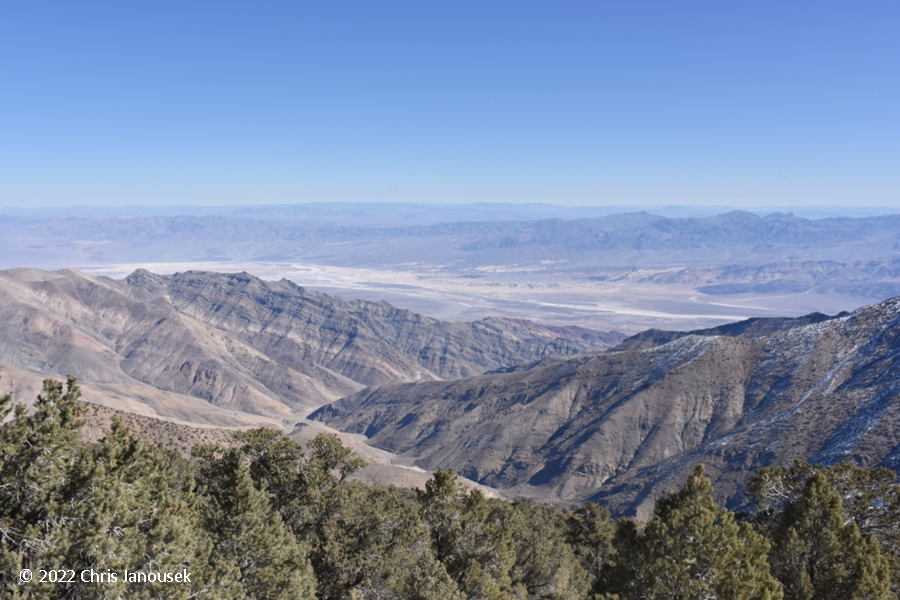
Coming up towards the park, we saw Joshua tree sentinels on the landscape. We
did not proceed deep into the park, but did drive through the Panamint Valley,
an utterly barren swath of land set between the Argus
Mountains to the west and the Panamint Range to the east. Though not hot on that late
December day, one could easily imagine the searing heat of the landscape during
the death days of summer.
Notes:
1. A concise history of Sierra geology.
2. Muir, J. 1911. My First Summer in the Sierra.
3.
The road was finally closed on 17 Jan 2012. See
the NPS data here.