Showing posts with label geology. Show all posts

15 June 2019

Yellowstone's hydrothermals

I haven’t posted on this blog for a year (!) and I have a number of trips to get caught up on, starting with a fun week in Wyoming at Yellowstone and Grand Tetons during late summer of last year.

Hydrothermal feature called "The Fisher"
at the edge of Yellowstone Lake. 
Yellowstone is the oldest national park in the world and I’m sure visitors arrive in this northwest corner of Wyoming for many reasons. For me, the hydrothermal features were the most exciting part of my first visit to this iconic park last summer.

The park’s hydrothermal features owe their existence to a geologic hotspot that lies under Yellowstone. Like the hotspots under the Hawaiian Islands, Iceland, and other locations across the planet, geologic hotspots are places where hot magma rises closer to the Earth’s surface than elsewhere. The volcanic intrusions into the crust heat groundwater that then rises to the land surface in a variety of forms.

One geologic signature of hotspots that I find fascinating is the volcanic traces they leave over the surface of the Earth over geologic time. As the tectonic plates comprising the crust move over the mantle (in the case of Yellowstone it is movement of the North American Plate), the hotspot remains relatively fixed below the moving plates and a “trail” of volcanic activity develops at the land surface over millions of years. This phenomenon is very easily observed with the island chain of Hawaii that formed as the Pacific Plate has gradually moved to the northwest over the Hawaiian hotspot. The trail of evidence is the string of Hawaiian Islands and Emperor seamounts across the north Pacific. In the case of Yellowstone, the history of volcanic activity in that region over the last 15 million years or so can be seen as a series of surface volcanic features that stretches from northwest Wyomingto southeast Oregon.

The Yellowstone caldera and hydrothermal features inside the national park boundaries. Base map from NPS.

Yellowstone has experienced volcanic eruptions a few times over the last several million years, but today volcanic activity in the park is just manifest as earthquakes and numerous hydrothermal features. Four types of hydrothermal phenomena are present in the park. Each is fueled by heat from below the surface, but all involve water at different temperatures and in different quantities. Mud pots consist of little basins of heated mud of different consistencies at the ground surface. The mud inside the pot is formed when acids dissolve rocks. As steam rises through the mud, it gurgles or bubbles at the ground surface. In Yellowstone, I was able to view mud pots at the Artist’s mud pots area southeast of the Grand Canyon of the Yellowstone.

Four types of hydrothermal features at Yellowstone. By CNJ, after NPS display.

Mud plots.


Steam vents, or fumaroles, are a second type of hydrothermal feature. They release super heated water vapor through sub-surface vents. Fumaroles can be small, just quietly releasing a steady stream of steam.

A fumarole near the Artists' Paintpots.

Castle Geyser erupting.
Geysers have subsurface reservoirs that fill with heated water which is periodically ejected violently through an opening in the ground. Geysers can erupt with predictable periodicity or can have irregular timing. Yellowstone has the greatest concentration of geysers anywhere in the world. They are diverse in terms of eruption height and periodicity.

Old Faithful is among the class of regularly-erupting geysers, though it is not the tallest geyser in Yellowstone. It erupts approximately every 70 minutes, and I saw several eruptions during the few days we were in the park. For me, a more impressive geyser was Castle Geyser which only erupts about every 12 hours, but for an impressive 20-30 minutes at a time. I was fortunate to catch one of its episodes. Both Old Faithful and Castle Geyser are in the Upper Geyser Basin where there are a wide variety of interesting hydrothermal features.

Hot springs are the final type of hydrothermal feature. At hot springs, heated water forms pools at the ground surface. They can be rather quiescent or quite active like the Beach Spring which periodically alternates between calm conditions and a vigorous flush of bubbles that rise to the surface of the pool that lasts for a minute or two. 

Examples of hot springs in Biscuit Basin. Shell Spring (left) and Mustard Spring (right).

Hot springs are often lined with precipitated minerals and microbial assemblages, lending them a variety of colors. Blue hues are due to the reflection of other colors of light from the pool. Yellow colors are due to precipitated sulfur compounds. Photosynthetic cyanobacteria and other algae may lend green colors to the water. Bacterial mats at the edges of pools may be white, black, or reddish in color.

Many of the more attractive hot spring pools have two or three colors, but the chromatic display at Yellowstone is most brilliant at Grand Prismatic Spring. This spring is so large it looks like a small lake. Lying across a large flat muddy treeless expanse, steam billows from the superheated spring. When the steam clears, the Grand Prismatic has a beautiful spectrum of blue, green, yellow, and orange.

Grand Prismatic Spring as seen from a trail on the west side of the lake (left) and from up close (right).

Boardwalks facilitate an up-close view of the Grand Prismatic Spring from the east side at ground level, but a short trail that climbs a nearby hillside also leads to a view from above. Since we were backcountry camping for two nights in a forest just a short distance from Grand Prismatic Spring, we viewed it on several occasions and from different angles. In the cool mornings, the brilliant colors of the pool were generally obscured by a large cloud of steam perpetually rising from the spring. However, later in the day as air temperatures warmed, there was less steam to block the rainbow of colors.

Our last of several visits to Grand Prismatic also held an unusual surprise. While we were out on the farthest boardwalk near the edge of the spring, a bison crossed over the boardwalk behind us and into the mudflat to the east of the spring. It seemed unfazed by either the runoff from the spring (which I presume was rather warm), or the eager tourists eyeing the huge animal. In no rush, it seemed unsure of where to go next. We left before learning of the resolution of that event. Curiously I had earlier seen some animal prints in the soil close to the spring, and this surprise visit confirmed that bison do wander quite close to the hydrothermal features from time to time. 


Several examples of smaller springs in Upper Geyser Basin.


The Sapphire Pool in Biscuit Basin.

02 June 2018

Bryce Canyon


Bryce Canyon is the smallest of Utah’s five national parks, and the last I have been able to visit. It also appears to be the youngest geologically of the parks, at least at the level of its world-famous amphitheater.

Panorama of the Bryce Canyon amphitheater.

Bryce sits at the top of the sedimentary rock strata of southern Utah that is known as the “Grand Staircase”, a series of geologic steps stretching geographically from southern Utah to the Grand Canyon that expose hundreds of millions of years of geologic history. The grand staircase formed by tilting of the ground and erosion of these sedimentary layers. The beauty of the area in part is due to the different colors of the sedimentary layers.

Stratigraphic layers of the Grand Staircase in northern Arizona and southern Utah. Lower image by
National Park Service, public domain.

The amphitheater carved into the eastern side of Bryce Canyon was the impetus for the creation of the park nearly 100 years ago. It is a stunning collection of sandstone spires known as hoodoos. These reddish rocks are relatively young (of Cenozoic age) and are part of the Claron Formation, one of the youngest layers of rock in the park.

The hoodoos are packed tightly together in an arena just below a plateau at the park’s entrance. Their formation is fascinating and complicated, involving steps of crisscrossed ground fractures and differential erosion. Hoodoos are a type of geologic spire, unique because they vary in width from top to bottom due to different rates of erosion of the rock. At Bryce the hoodoos are mostly reddish in color (that indicates oxidized iron in the rock), but there are lovely bands of whitish rock too that decorate the amphitheater.

Hoodoos in the Bryce Canyon Amphitheater.

The other white that decorated the area in early May was snow – which was falling due to precipitation moving through Utah that week and the high elevation of the park. Snow fell on and off the afternoon I arrived at Bryce, sometimes in large flakes. The tops of hoodoos and other surfaces around the amphitheatre were left with a thin dusting of white that added vibrancy to the red rocks.

The Pink Cliffs with a light layer of spring snow.
That night I camped at the southern end of the park at about 8500 ft elevation. I drove to Rainbow Point (9115 ft), and then descended a few hundred feet over a mile and a half along an easy trail to a backpacking campsite at Yovimpa Pass. There was little doubt it was going to be a cold night, but I stayed dry during the hike and doubled up on clothes overnight, keeping me reasonably warm. About midnight I could hear the patter of snow on the tent, and I awoke to an inch or so of snow on the tent and forest floor in the morning.

Snow on my tent and borrowed bear canister in the morning.

Small waterfall and hoodoos at the northern
end of the park.
At such a high elevation, Bryce was well forested, mainly with pines near the amphitheater, and mixed conifer species at higher elevations, including firs. Rainbow Point also had a conifer species I have wanted to see for quite some time: the Bristlecone Pine! These ancient craggy botanical sentinels occurred in a population at the windy edge of the point. The Bristlecone Pine deserves its own post, so I’ll defer writing about it more for now.

Bryce was crowded and touristy (near the roads), but well worth a visit! My backcountry experience stood in contrast to the easily accessible areas of the park – there was not a soul in sight for my overnight trip to Yovimpa Pass – and I think a future backcountry trip through Bryce would be well worth it!

Reference

Morris TH, Ritter SM, Laycock DP. 2012. Geology Unfolded. An Illustrated Guide to the Geology of Utah’s National Parks. BYU Press.


23 April 2017

A grand view at Canyonlands

Southwest of Arches in Utah is Canyonlands National Park, a part of the Colorado Plateau centered on the meeting point of the Colorado and Green Rivers. The landscape of this area is dominated by the deep valleys forged over eons of time by the rivers. I spent only a few hours in the park, exploring a small part of “Island in the Sky”, one of several major sections of the park.

Fisheye view of the canyon formed by the Green River.

Candlestick Tower in the Green River Valley.
At the southern tip of Island in the Sky, the meandering Colorado River flowing from the northeast meets the meandering Green River flowing from the north. A short trail leads out along the edge of the mesa presenting tremendous views of the deep canyons in a panoramic view from the southeast to the west. The canyons are immense in size and spectacular in their topographic variety.

From atop the mesa, the first “level” of the canyons consists of a drop of over a thousand feet into wide expansive valleys. From there, there are canyons that descend further until finally one reaches deeper sinuous gorges. The rivers are so deep despite their massive erosional footprint that they cannot be seen from the high mesas above.

On the Green River side there are a few reddish flat-topped buttes that stand out distinctly like crumbling Grecian buildings on the landscape. On the Colorado side, the deeply lobed gorge is decorated with a scattering of white-topped columns that reach up to the level of the upper basin. I think these would technically be called “hoodoos”. All of these shapes and colors are mesmerizing and one feels like soaring above to take it all in.

Junction Butte and the canyonlands around the confluence of the Green and Colorado Rivers.


Reference

NPS. Canyonlands National Park map.

Columns within Monument Basin in the Colorado
River canyon.
Fisheye view of the Colorado River Canyon with Monument Basin at left.

20 April 2017

Ancient Arches

Landscape Arch (over 300 ft long!) in the Devil's
Garden region of the park.
At Arches National Park, one can’t help but be preoccupied with geology (even if you’re a biologist). The blooming Ephedra, desert lizards sunning themselves, and twisted Juniper are impressive, but for a first time visitor to Arches like me, it is the sheer scale of rock and erosion that first hits the senses (more on the biota later).

Arches is near the heart of the Colorado plateau, a region roughly centered on the four corners of the US. Across the area, rivers like the Colorado and Green cut deeply into the ancient rock, eroding meandering canyons. Water is responsible in part for the formation of rock arches too. The process begins with cracks that form in a solid block of sandstone (a type of rock called Entrada sandstone is particularly conducive to arch formation). These cracks form in parallel bands. Water erodes along these cracks, eventually creating a series of parallel ridges of rocks known as fins. The final step in arch formation occurs when water (with a mild acid) pools above a denser layer of rock within an individual fin and slowly dissolves a cavity in the sandstone by loosening the matrix holding the sandstone particles together.

Two views of "Double O" Arch, also in the Devil's Garden region.

A sandstone spire in the foreground with the La Sal
Mountains in the background. I really liked the
juxtaposition of erosion-dominated sandstone with
the (probably) more recently uplifted mountains.
In addition to the arches for which the park is famous, the rust-colored sandstone takes on a variety of shapes, from sheer rock walls to spires. Flat-topped mesas, like ancient ruins crumbling over eons are present too, both inside and outside Arches. These formations were among my favorite, perhaps in part because the buttresses of rubble around their bases emphasized the process of decay and suggested their great age.

During the last two days in eastern Utah, the forces of erosion dominate in this region in my mind, manifest in every major shape on the landscape. Erosion is everywhere, whether orderly like grooves in the soft earth or chaotic like a jumble of boulders that remain from a cataclysmic collapse of a rock formation.

References

Arches National Park Visitors Guide, published by Canyonlands Natural History Association, and National Park Service interpretive signs.

Morris TH, Ritter SM, Laycock DP. 2012. Geology Unfolded. An Illustrated Guide to the Geology of Utah’s National Parks. BYU Press.


Sandstone fins (left) and decorative features in sandstone (right).
This region of the park is known as the Courthouse Towers and was one of my favorite areas.
Another view of sandstone formationa and the La Sal
Mountains in the background.
This is Delicate Arch, the iconic arch of the National Park.
I wonder how this precariously perched rock (top center)
got in that position. Earthquake? Slow action of
(frozen) water?

18 April 2017

The Great Basin

The Great Basin region of the United States is a series of alternating mountain ranges and wide valleys stretching across Nevada and western Utah. The mountain ranges run north to south, breaking up the monotony of the Nevada landscape. The alternating mountain ranges and valleys formed through a process of faulting and stretching of the crust.

I confess to seldom thinking of Nevada as a place to explore as a naturalist. It has long seemed a place to just pass through while en route to more interesting destinations. However, in my first trip across central Nevada from the Sierra near the Tahoe region to Great Basin National Park in the western reaches of the state, I was stuck by the unexpected beauty of the landscape.

Heading west to east, the parallel ranges of mountains seem to have become increasingly attractive. The Toiyabe and Egan ranges in central Nevada in particular were notable. Most of the ranges are still wearing crowns of snow which add some vibrancy to the earthen tones of the landscape. Junipers became more frequent towards the eastern part of the state, forming pygmy forests at higher elevations.
Sand Mountain (left) and the Egan Range (right).

Traversing Nevada, I stopped only briefly at places, to photograph the mountains and look at weathered petroglyphs off the highway. US route 50, which winds through the basins and ranges is proudly advertised as “the loneliest road in America”.

Approaching the eastern edge of Nevada, the bright white Wheeler Peak came into view from the previous range to the west. At over 13,000 ft elevation, it forms the centerpiece of Great Basin National Park, an oasis of forest and snow. The main entrance to the park is on the eastern side, nearly in Utah. There, Lehman Creek runs off Wheeler Peak towards the lowlands.

Great Basin National Park, as viewed from near Sacramento Pass.

 Yesterday evening I hiked along part of the trail that follows the creek up the slopes of the mountains. There, at about 8000’, was a fairly dense forest that reminded me superficially of the forested Cascades, though the main conifer species differed. Single leaf pinyon pines (Pinus monophylla) was the dominant species, joined by at least two other conifers: Rocky Mountain fir, and Engelmann’s spruce. The most attractive trees to me were not the conifers, but white-barked hardwoods, still leafless, which I think are probably quaking aspens (Populus tremuloides). Their white or grey trunks (sometimes taking on greenish or orange hues), stood like skeletons, waiting to be clothed again with new leaves for another growing season.

Populus trees at about 8000 ft elevation near Lehman Creek.

According to the Park Service ranger, this is the most
iconic feature of Lehman Caves and is known as the
"parachute". It combines several types of formations
including "shields" (at top), "drapery", and "columns".
This morning I availed myself of perhaps the main attraction of the park, Lehman Caves. Following a guide for an hour and a half, our group walked through narrow passageways and larger chambers, observing thousands of limestone sculptures, each slowly built over hundreds or thousands of years and each unique. There is an entire geologic vocabulary for the major shapes formed by the precipitates, names which include columns, drapery, soda straws, shields, and popcorn. In the array of formations, Lehman Cave was much like the Oregon Caves that I visited last summer.

After the undulation of the Great Basin, I am off to the Colorado Plateau.

References

Kauffman ME. 2013. Conifers of the Pacific Slope. Backcountry Press, Kneeland, CA.

Little EL. 1979. Forest trees of the United States and Canada, and how to identify them. Dover Publications Inc., New York


"Soda straws" on the ceiling of the cave. All stalagtites start their existence as soda straws.
More "drapery" from the cave.
Single leaf pinyon. Along with juniper, this species
was very common in Great Basin National Park.

23 November 2015

Origin of the Hawaiian Islands

Mauna Kea from the west, Nov 2015.
From a geologic perspective, Hawaii is an ephemeral and dynamic anomaly. The islands’ origins lie deep undersea where a large hotspot feeds a succession of active volcanoes underneath the center of the Pacific plate. Measured against geologic history, each island lives a very short life - they burst forth from the sea floor and then quickly drown under the forces of erosion.

Hawaiian volcanoes are the largest on earth, by height (as measured from the sea floor) and by total mass. In fact, their mass is so great that they depress the Earth’s crust in their vicinity. Whereas the typical depth of the seafloor might be 4.5 km, near Maui and the Big Island, the volcanic giants push sea floor depths to over 9 km.

The arc of the Hawaiian Islands formed as a result of the northwest-ward movement of the Pacific plate, currently estimated at a rate of 10 cm per year. New volcanoes form over the hotspot with great rapidity, taking only about 0.3 million years between their inception and the point at which they break the ocean surface. The Big Island is the youngest in the Hawaiian chain, with the oldest rocks dated to about 0.6 million years. Oahu formed about 3-4 mya, and Kaua’i and Ni’ihau have the oldest rocks at about 6 million years old.

The Hawaiian archipelago. Map from Langenbeim and Clague (1987).

To the northwest of the main Hawaiian Islands lies a series of atolls (including Kure and Midway), which are volcanic islands in their old age, hanging on to the sea surface by their reef building corals. Farther into the north Pacific, the Hawaiian Island chain bends northward and becomes the Emperor Seamounts which stretch towards Russia. The bend in the path is dated to about 43 mya, and the change in course of the Pacific plate is believed to be linked to the collision of the Indian subcontinent with Asia at that time. 

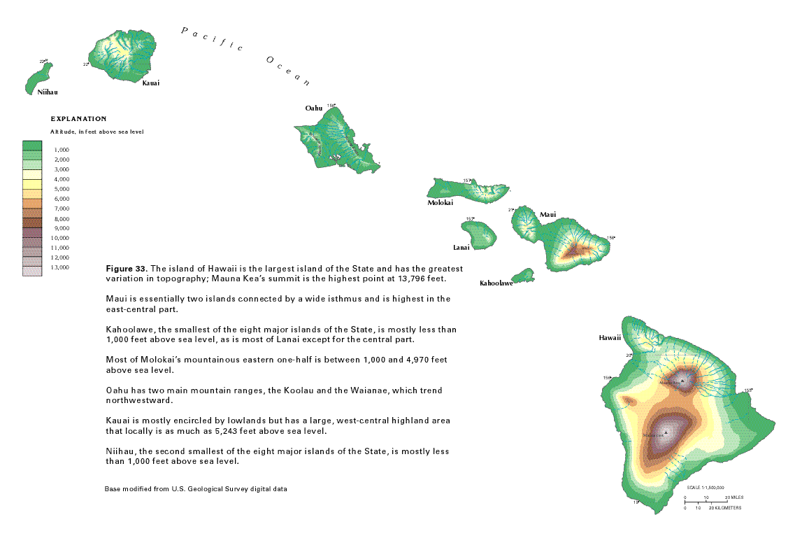
Topography of the Big Island, Hawaii, with elevations in feet. Mauna
Kea (north) and Mauna Loa (south) both exceed 13,000 ft elevation.
Map modified from USGS, "Ground Water Atlas of the United
States. Source.
Hawaiian volcanoes progress through 4 stages, starting with the preshield phase when volcanic activity begins. Stage 2 is the shield stage and is the most active period of volcanic activity when the vast majority of the volcano’s volume is created. Magma rises from the hotspot located as deep as 60-70 below the crust where it is stored in shallow reservoirs. During volcano growth, erupting lava emerges both from the summit of the volcano and from several lateral rift zones. The post-shield stage is next, and consists of additional volcanic activity for about 0.1 to 0.3 million years after the shield stage. Finally, after perhaps a quiescent period, there is the rejuvenated stage, a period of variable length where some additional volcanic activity may occur. The Big Island is the only Island in the shield stage. Landslides and erosion gradually wear down the volcanoes.

There are five volcanoes comprising the Big Island: Kohala, Mauna Kea, Hualalai, Mauna Loa, and Kilauea. Only the latter two have erupted recently. Kilauea is the most active volcano in the world. I hope to see lava flows when we visit the National Park in a few days. A bit to the southeast of the Big Island lies the submerged Loihi, which is the newest volcano in the long Hawaiian chain. Some thousands of years into the future, it may form its own island by breaking the ocean surface or it may merge with its neighbors to grow the size of the Big Island.

The five volcanoes of the Big Island. Map and key modified from Sherrod et al. (2007).


References

Clague DA, Dalrymple GB. 1987. The Hawaiian-Emperor Volcanic Chain. Part I. Geologic Evolution. USGS Professional Paper 1350.

Langenbeim VAM, Clague DA. 1987. The Hawaiian-Emperor Volcanic Chain. Part II. Stratigraphic Framework of Volcanic Rocks of the Hawaiian Islands. USGS Professional Paper 1350.

Sherrod DR. 2009. Hawaiian Islands, Geology. In: Encyclopedia of Islands, Gillespie RG and Clague DA (eds), University of California Press, Berkeley, CA, p.404-410.

Sherrod DR, Sinton JM, Watkins SE, Brunt KM. 2007. Geologic Map of the State of Hawai’i. USGS Open-File Report 2007-1089.

04 October 2015

Crater Lake

Crater Lake National Park was the last significant stop on my recent trip to the Pacific Northwest. Located about 50 miles north of the California border, it is the only national park in Oregon. The park centers on the magnificent lake with its deep, cold, and intensely blue waters.

Crater Lake and Wizard Island (center) from the southwest side of rim drive.

Wizard Island is a small crater that formed inside Crater Lake
after the massive eruption of Mount Mazama (NPS 2013). With
its beautiful shape, it is my favorite feature of the Park.
The crater in which the lake rests was formed by a massive volcanic explosion some 7700 years ago. Prior to this cataclysmic eruption, Mount Mazama was one of the highest peaks in the Cascade Range, reaching about 12,000 feet in elevation (NPS 2013). The area has breathtaking vistas and holds fascinating lessons in geology.

I camped for a single night at Lost Creek campground, a small site among pines on the eastern slope of the mountain. It was the night of the lunar eclipse and blood moon and Crater Lake was the perfect location for sky watching. At about full eclipse in the late evening (approximately 8 PM PDT), hundreds of stars were visible in the darkened sky because of the obscured moon. Later, after the eclipse lapsed, the landscape became much more illuminated from the brilliant full moon. I drove back down the road a few miles from the campsite to the pinnacles area that I had visited just before sunset.

Pinnacles at the southeast side of the park. The discreet bands of color show
the evolving composition of volcanic material as it was erupted from Mount
Mazama 7700 years ago (NPS 2013).
I have made a few day trips to Crater Lake in the past, but saw the pinnacles for the first time on this trip. Formed during the last eruption, they stand as spires on both sides of a wide valley cut into the eastern slope of Mount Mazama. In essence, during the eruption large flows of hot ash poured down the slopes of the mountain. Heated gases rose through the ash to escape into the atmosphere over time, hardening columns of mud (called “tuff”) surrounding the gaseous vents. Finally over time, erosion removed the softer ash but not the more hardened columns of mudstone surrounding the vents, leaving a landscape of spires for us to admire today (NPS 2013).

Crater Lake from the trail at Cleetwood
Cove.


In the morning following a cold night of camping, I hiked down the only trail that leads from the rim of the crater to the lake itself. It is a short but moderately steep trail that passes through light conifer forest. The water of the lake was calm, reflecting sparkles from the sun in the east. At the end of the trail there is a boat launch (for paid tours to Wizard Island), and a small shack housing a water level measurement station. I put my feet in the cold lake in the warm morning sun.

The history of Crater Lake is one of violent geologic forces, but the placid lake and singing birds on a warm morning in early fall, and the green carpets of forest on Mount Mazama’s slopes belied its turbulent past.

Reference
National Park Service (2013). Crater Lake National Park. Geologic Resources Inventory Report. Natural Resource Report NPS/NRSS/GRD/NRR-2013/719


The pinnacles illuminated by the full moon.
The eclipse and blood moon from the Park.